You are here: Home > Network List > US - United States National Seismic Network Stations List
> Station AMTX Amarillo, Texas, USA > Earthquake Result Viewer
AMTX Amarillo, Texas, USA - Earthquake Result Viewer
*The percent match for this event was below the threshold and hence no stack was calculated.
| Earthquake location: |
Azores Islands Region |
| Earthquake latitude/longitude: |
42.1/-29.3 |
| Earthquake time(UTC): |
2014/05/26 (146) 19:43:14 GMT |
| Earthquake Depth: |
7.1 km |
| Earthquake Magnitude: |
5.0 MW |
| Earthquake Catalog/Contributor: |
ISC/ISC |
|
| Network: |
US United States National Seismic Network |
| Station: |
AMTX Amarillo, Texas, USA |
| Lat/Lon: |
34.53 N/101.41 W |
| Elevation: |
1010 m |
|
| Distance: |
55.6 deg |
| Az: |
287.717 deg |
| Baz: |
59.192 deg |
| Ray Param: |
$rayparam |
*The percent match for this event was below the threshold and hence was not used in the summary stack. |
|
| Radial Match: |
69.34013 % |
| Radial Bump: |
400 |
| Transverse Match: |
70.441315 % |
| Transverse Bump: |
398 |
| SOD ConfigId: |
3390531 |
| Insert Time: |
2019-04-12 01:23:42.183 +0000 |
| GWidth: |
2.5 |
| Max Bumps: |
400 |
| Tol: |
0.001 |
|
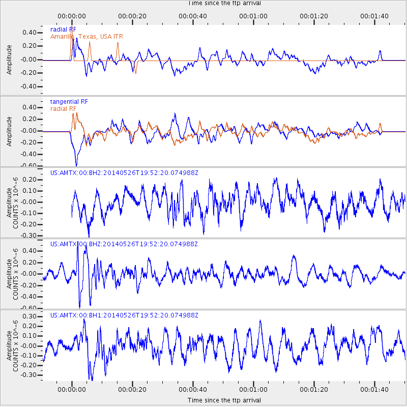
Signal To Noise
| Channel | StoN | STA | LTA |
| US:AMTX:00:BHZ:20140526T19:52:20.074988Z | 4.5007563 | 2.991458E-7 | 6.6465674E-8 |
| US:AMTX:00:BH1:20140526T19:52:20.074988Z | 0.592052 | 8.645901E-8 | 1.460328E-7 |
| US:AMTX:00:BH2:20140526T19:52:20.074988Z | 1.1147354 | 1.0157913E-7 | 9.112399E-8 |
| Arrivals |
| Ps | |
| PpPs | |
| PsPs/PpSs | |


