You are here: Home > Network List > TA - USArray Transportable Network (new EarthScope stations) Stations List
> Station T25A Trinidad, CO, USA > Earthquake Result Viewer
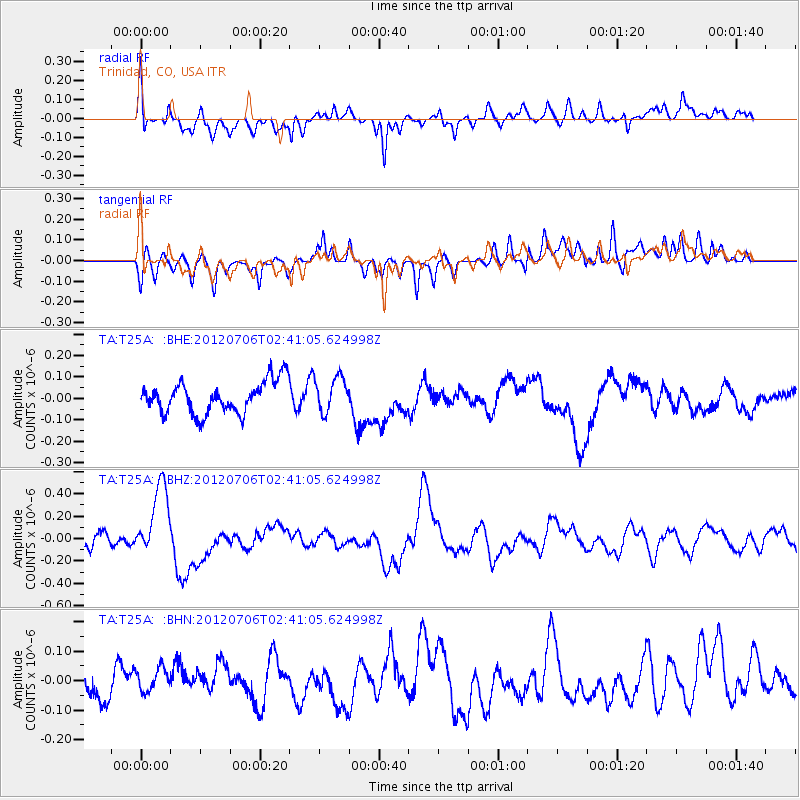
T25A Trinidad, CO, USA - Earthquake Result Viewer
*The percent match for this event was below the threshold and hence no stack was calculated.
| Earthquake location: |
Vanuatu Islands |
| Earthquake latitude/longitude: |
-14.7/167.3 |
| Earthquake time(UTC): |
2012/07/06 (188) 02:28:22 GMT |
| Earthquake Depth: |
160 km |
| Earthquake Magnitude: |
5.7 MB, 6.3 MW, 6.3 MW |
| Earthquake Catalog/Contributor: |
WHDF/NEIC |
|
| Network: |
TA USArray Transportable Network (new EarthScope stations) |
| Station: |
T25A Trinidad, CO, USA |
| Lat/Lon: |
37.14 N/104.41 W |
| Elevation: |
2017 m |
|
| Distance: |
97.3 deg |
| Az: |
53.642 deg |
| Baz: |
257.261 deg |
| Ray Param: |
$rayparam |
*The percent match for this event was below the threshold and hence was not used in the summary stack. |
|
| Radial Match: |
56.452374 % |
| Radial Bump: |
400 |
| Transverse Match: |
44.49449 % |
| Transverse Bump: |
400 |
| SOD ConfigId: |
463687 |
| Insert Time: |
2013-02-20 19:25:56.428 +0000 |
| GWidth: |
2.5 |
| Max Bumps: |
400 |
| Tol: |
0.001 |
|
Signal To Noise
| Channel | StoN | STA | LTA |
| TA:T25A: :BHZ:20120706T02:41:05.624998Z | 4.360777 | 3.2943882E-7 | 7.55459E-8 |
| TA:T25A: :BHN:20120706T02:41:05.624998Z | 1.0606698 | 5.5471865E-8 | 5.2298905E-8 |
| TA:T25A: :BHE:20120706T02:41:05.624998Z | 1.0968478 | 8.139682E-8 | 7.4209765E-8 |
| Arrivals |
| Ps | |
| PpPs | |
| PsPs/PpSs | |


