You are here: Home > Network List > UW - Pacific Northwest Regional Seismic Network Stations List
> Station PASS Maple Falls, WA, USA > Earthquake Result Viewer
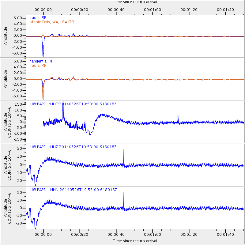
PASS Maple Falls, WA, USA - Earthquake Result Viewer
*The percent match for this event was below the threshold and hence no stack was calculated.
| Earthquake location: |
Azores Islands Region |
| Earthquake latitude/longitude: |
42.1/-29.3 |
| Earthquake time(UTC): |
2014/05/26 (146) 19:43:14 GMT |
| Earthquake Depth: |
7.1 km |
| Earthquake Magnitude: |
5.0 MW |
| Earthquake Catalog/Contributor: |
ISC/ISC |
|
| Network: |
UW Pacific Northwest Regional Seismic Network |
| Station: |
PASS Maple Falls, WA, USA |
| Lat/Lon: |
49.00 N/122.09 W |
| Elevation: |
174 m |
|
| Distance: |
61.4 deg |
| Az: |
311.495 deg |
| Baz: |
57.845 deg |
| Ray Param: |
$rayparam |
*The percent match for this event was below the threshold and hence was not used in the summary stack. |
|
| Radial Match: |
97.59366 % |
| Radial Bump: |
168 |
| Transverse Match: |
95.12009 % |
| Transverse Bump: |
252 |
| SOD ConfigId: |
3390531 |
| Insert Time: |
2019-04-12 01:24:22.296 +0000 |
| GWidth: |
2.5 |
| Max Bumps: |
400 |
| Tol: |
0.001 |
|
Signal To Noise
| Channel | StoN | STA | LTA |
| UW:PASS: :HHZ:20140526T19:53:00.618018Z | 1.0941647 | 7.1256172E-6 | 6.512381E-6 |
| UW:PASS: :HHN:20140526T19:53:00.618018Z | 1.0943626 | 7.604467E-6 | 6.9487637E-6 |
| UW:PASS: :HHE:20140526T19:53:00.618018Z | 1.7498686 | 6.97697E-5 | 3.9871393E-5 |
| Arrivals |
| Ps | |
| PpPs | |
| PsPs/PpSs | |


