You are here: Home > Network List > UW - Pacific Northwest Regional Seismic Network Stations List
> Station FISH Seaside, OR, USA > Earthquake Result Viewer
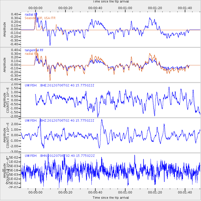
FISH Seaside, OR, USA - Earthquake Result Viewer
*The percent match for this event was below the threshold and hence no stack was calculated.
| Earthquake location: |
Vanuatu Islands |
| Earthquake latitude/longitude: |
-14.7/167.3 |
| Earthquake time(UTC): |
2012/07/06 (188) 02:28:22 GMT |
| Earthquake Depth: |
160 km |
| Earthquake Magnitude: |
5.7 MB, 6.3 MW, 6.3 MW |
| Earthquake Catalog/Contributor: |
WHDF/NEIC |
|
| Network: |
UW Pacific Northwest Regional Seismic Network |
| Station: |
FISH Seaside, OR, USA |
| Lat/Lon: |
45.93 N/123.56 W |
| Elevation: |
325 m |
|
| Distance: |
86.5 deg |
| Az: |
40.786 deg |
| Baz: |
244.942 deg |
| Ray Param: |
$rayparam |
*The percent match for this event was below the threshold and hence was not used in the summary stack. |
|
| Radial Match: |
58.812763 % |
| Radial Bump: |
400 |
| Transverse Match: |
58.9512 % |
| Transverse Bump: |
400 |
| SOD ConfigId: |
463687 |
| Insert Time: |
2013-02-20 19:30:27.987 +0000 |
| GWidth: |
2.5 |
| Max Bumps: |
400 |
| Tol: |
0.001 |
|
Signal To Noise
| Channel | StoN | STA | LTA |
| UW:FISH: :BHZ:20120706T02:40:15.775022Z | 5.655388 | 1.2548298E-6 | 2.2188219E-7 |
| UW:FISH: :BHN:20120706T02:40:15.775022Z | 0.9736397 | 5.859016E-9 | 6.017643E-9 |
| UW:FISH: :BHE:20120706T02:40:15.775022Z | 1.2164036 | 4.2812243E-7 | 3.5195757E-7 |
| Arrivals |
| Ps | |
| PpPs | |
| PsPs/PpSs | |


