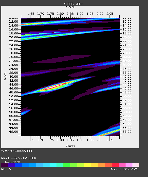
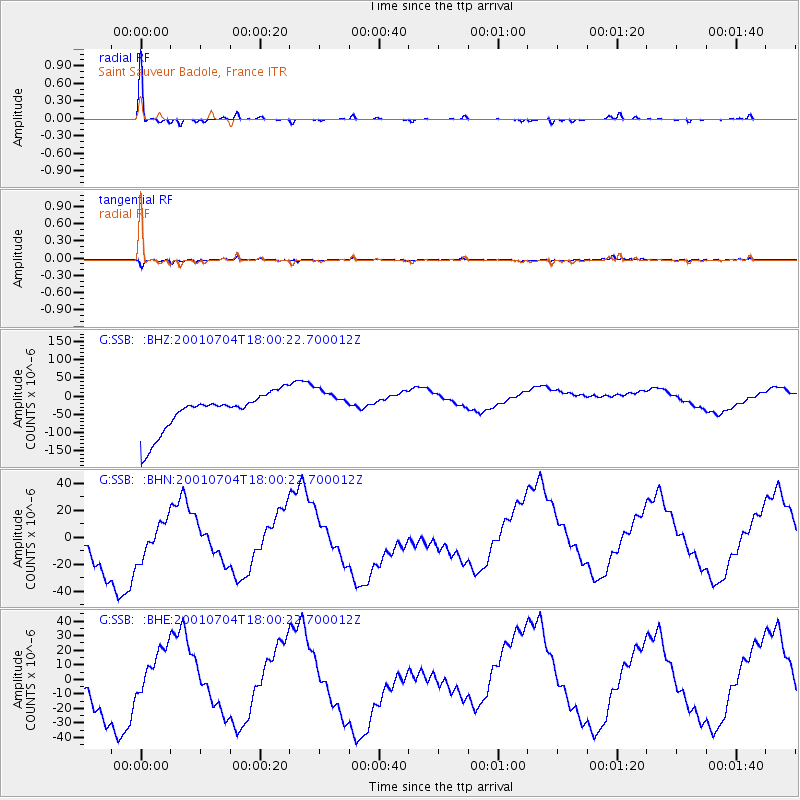
SSB Saint Sauveur Badole, France - Earthquake Result Viewer

Earthquake location: Southeast Of Honshu, Japan
Earthquake latitude/longitude: 32.2/139.5
Earthquake time(UTC): 2001/07/04 (185) 17:47:45 GMT
Earthquake Depth: 33 km
Earthquake Magnitude: 5.4 MB, 5.5 MS, 5.8 MW, 5.7 MW
Earthquake Catalog/Contributor: WHDF/NEIC
Network: G GEOSCOPE
Station: SSB Saint Sauveur Badole, France
Lat/Lon: 45.28 N/4.54 E
Elevation: 700 m
Distance: 92.8 deg
Az: 330.013 deg
Baz: 36.902 deg
Ray Param: 0.041381188
Estimated Moho Depth: 45.0 km
Estimated Crust Vp/Vs: 1.76
Assumed Crust Vp: 6.1 km/s
Estimated Crust Vs: 3.471 km/s
Estimated Crust Poisson's Ratio: 0.26
Radial Match: 89.45338 %
Radial Bump: 132
Transverse Match: 68.534645 %
Transverse Bump: 225
SOD ConfigId: 3753
Insert Time: 2010-02-27 00:14:03.547 +0000
GWidth: 2.5
Max Bumps: 400
Tol: 0.001

Signal To Noise

ChannelStoNSTALTA
G:SSB: :BHN:20010704T18:00:22.700012Z0.783381942.526648E-53.225308E-5
G:SSB: :BHE:20010704T18:00:22.700012Z0.675098841.3898121E-52.0586795E-5
G:SSB: :BHZ:20010704T18:00:22.700012Z0.89472374.6855374E-55.236854E-5
Arrivals
Ps5.7 SECOND
PpPs20 SECOND
PsPs/PpSs26 SECOND