You are here: Home > Network List > TA - USArray Transportable Network (new EarthScope stations) Stations List
> Station TOLK Toolik Lake Research Station, AK, USA > Earthquake Result Viewer
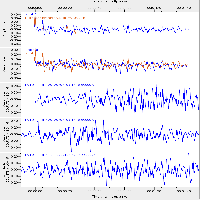
TOLK Toolik Lake Research Station, AK, USA - Earthquake Result Viewer
*The percent match for this event was below the threshold and hence no stack was calculated.
| Earthquake location: |
New Ireland Region, P.N.G. |
| Earthquake latitude/longitude: |
-4.7/153.3 |
| Earthquake time(UTC): |
2012/07/07 (189) 03:35:28 GMT |
| Earthquake Depth: |
35 km |
| Earthquake Magnitude: |
5.6 MB, 5.3 MS, 5.7 MW, 5.7 MW |
| Earthquake Catalog/Contributor: |
WHDF/NEIC |
|
| Network: |
TA USArray Transportable Network (new EarthScope stations) |
| Station: |
TOLK Toolik Lake Research Station, AK, USA |
| Lat/Lon: |
68.64 N/149.57 W |
| Elevation: |
760 m |
|
| Distance: |
82.9 deg |
| Az: |
18.063 deg |
| Baz: |
237.524 deg |
| Ray Param: |
$rayparam |
*The percent match for this event was below the threshold and hence was not used in the summary stack. |
|
| Radial Match: |
68.79168 % |
| Radial Bump: |
400 |
| Transverse Match: |
65.89488 % |
| Transverse Bump: |
400 |
| SOD ConfigId: |
463687 |
| Insert Time: |
2013-02-20 19:41:47.132 +0000 |
| GWidth: |
2.5 |
| Max Bumps: |
400 |
| Tol: |
0.001 |
|
Signal To Noise
| Channel | StoN | STA | LTA |
| TA:TOLK: :BHZ:20120707T03:47:18.650007Z | 3.2797616 | 1.8903881E-7 | 5.7637976E-8 |
| TA:TOLK: :BHN:20120707T03:47:18.650007Z | 1.7764593 | 7.092422E-8 | 3.9924483E-8 |
| TA:TOLK: :BHE:20120707T03:47:18.650007Z | 1.3472381 | 5.8233944E-8 | 4.3224688E-8 |
| Arrivals |
| Ps | |
| PpPs | |
| PsPs/PpSs | |


