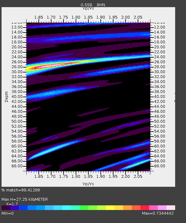
SSB Saint Sauveur Badole, France - Earthquake Result Viewer
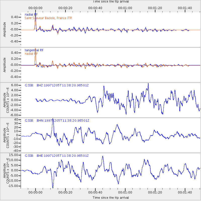
Earthquake location: Near East Coast Of Kamchatka
Earthquake latitude/longitude: 54.8/162.0
Earthquake time(UTC): 1997/12/05 (339) 11:26:54 GMT
Earthquake Depth: 33 km
Earthquake Magnitude: 6.3 MB, 7.6 MS, 7.9 UNKNOWN, 7.3 ME
Earthquake Catalog/Contributor: WHDF/NEIC
Network: G GEOSCOPE
Station: SSB Saint Sauveur Badole, France
Lat/Lon: 45.28 N/4.54 E
Elevation: 700 m
Distance: 78.4 deg
Az: 343.986 deg
Baz: 13.062 deg
Ray Param: 0.049594156
Estimated Moho Depth: 27.25 km
Estimated Crust Vp/Vs: 1.70
Assumed Crust Vp: 6.1 km/s
Estimated Crust Vs: 3.588 km/s
Estimated Crust Poisson's Ratio: 0.24
Radial Match: 98.41289 %
Radial Bump: 361
Transverse Match: 86.1939 %
Transverse Bump: 400
SOD ConfigId: 4480
Insert Time: 2010-02-27 00:14:56.972 +0000
GWidth: 2.5
Max Bumps: 400
Tol: 0.001

Signal To Noise

ChannelStoNSTALTA
G:SSB: :BHN:19971205T11:38:20.98501Z11.3488345.866114E-65.1689136E-7
G:SSB: :BHE:19971205T11:38:20.98501Z8.279112.3935224E-62.8910384E-7
G:SSB: :BHZ:19971205T11:38:20.98501Z2.94699298.4653414E-72.8725356E-7
Arrivals
Ps3.2 SECOND
PpPs12 SECOND
PsPs/PpSs15 SECOND