You are here: Home > Network List > TA - USArray Transportable Network (new EarthScope stations) Stations List
> Station M36A Felix, Anita, IA, USA > Earthquake Result Viewer
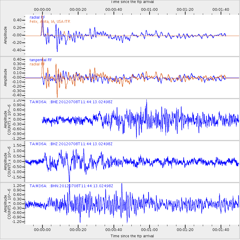
M36A Felix, Anita, IA, USA - Earthquake Result Viewer
*The percent match for this event was below the threshold and hence no stack was calculated.
| Earthquake location: |
Kuril Islands |
| Earthquake latitude/longitude: |
45.5/151.3 |
| Earthquake time(UTC): |
2012/07/08 (190) 11:33:02 GMT |
| Earthquake Depth: |
20 km |
| Earthquake Magnitude: |
5.7 MB, 5.6 MS, 6.0 MW, 5.8 MW |
| Earthquake Catalog/Contributor: |
WHDF/NEIC |
|
| Network: |
TA USArray Transportable Network (new EarthScope stations) |
| Station: |
M36A Felix, Anita, IA, USA |
| Lat/Lon: |
41.45 N/94.80 W |
| Elevation: |
430 m |
|
| Distance: |
75.3 deg |
| Az: |
45.283 deg |
| Baz: |
318.327 deg |
| Ray Param: |
$rayparam |
*The percent match for this event was below the threshold and hence was not used in the summary stack. |
|
| Radial Match: |
77.56696 % |
| Radial Bump: |
400 |
| Transverse Match: |
69.73561 % |
| Transverse Bump: |
400 |
| SOD ConfigId: |
463687 |
| Insert Time: |
2013-02-20 20:21:56.108 +0000 |
| GWidth: |
2.5 |
| Max Bumps: |
400 |
| Tol: |
0.001 |
|
Signal To Noise
| Channel | StoN | STA | LTA |
| TA:M36A: :BHZ:20120708T11:44:13.02498Z | 3.8593225 | 4.5016708E-7 | 1.1664407E-7 |
| TA:M36A: :BHN:20120708T11:44:13.02498Z | 1.4600215 | 1.7425096E-7 | 1.1934821E-7 |
| TA:M36A: :BHE:20120708T11:44:13.02498Z | 2.1174629 | 2.521107E-7 | 1.19062626E-7 |
| Arrivals |
| Ps | |
| PpPs | |
| PsPs/PpSs | |


