You are here: Home > Network List > TA - USArray Transportable Network (new EarthScope stations) Stations List
> Station L36A Harm Buss Farm, Glidden, IA, USA > Earthquake Result Viewer
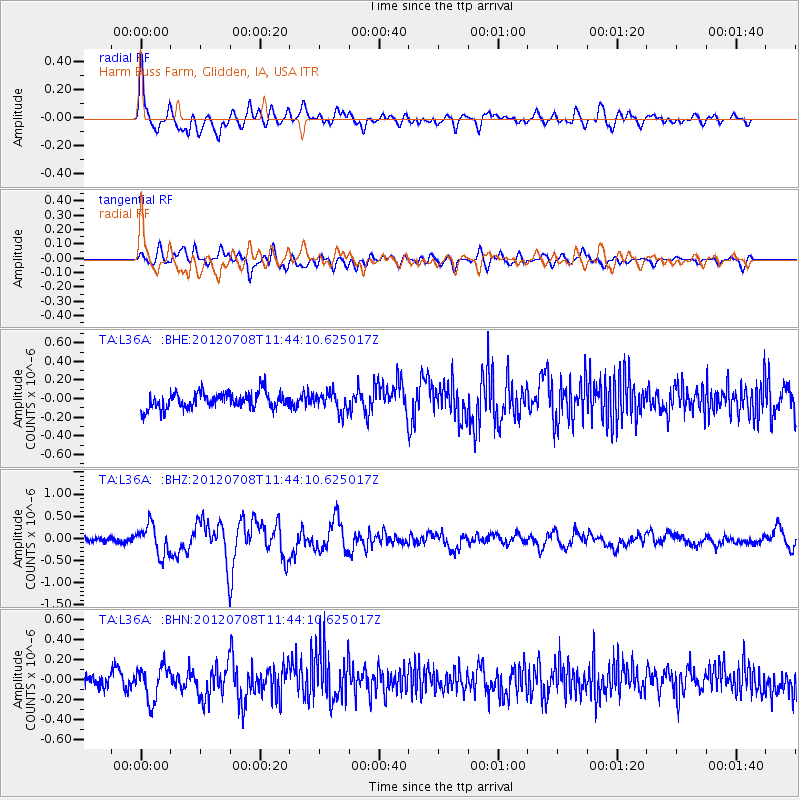
L36A Harm Buss Farm, Glidden, IA, USA - Earthquake Result Viewer
*The percent match for this event was below the threshold and hence no stack was calculated.
| Earthquake location: |
Kuril Islands |
| Earthquake latitude/longitude: |
45.5/151.3 |
| Earthquake time(UTC): |
2012/07/08 (190) 11:33:02 GMT |
| Earthquake Depth: |
20 km |
| Earthquake Magnitude: |
5.7 MB, 5.6 MS, 6.0 MW, 5.8 MW |
| Earthquake Catalog/Contributor: |
WHDF/NEIC |
|
| Network: |
TA USArray Transportable Network (new EarthScope stations) |
| Station: |
L36A Harm Buss Farm, Glidden, IA, USA |
| Lat/Lon: |
42.10 N/94.67 W |
| Elevation: |
353 m |
|
| Distance: |
74.8 deg |
| Az: |
44.76 deg |
| Baz: |
318.281 deg |
| Ray Param: |
$rayparam |
*The percent match for this event was below the threshold and hence was not used in the summary stack. |
|
| Radial Match: |
75.31161 % |
| Radial Bump: |
400 |
| Transverse Match: |
67.41613 % |
| Transverse Bump: |
400 |
| SOD ConfigId: |
463687 |
| Insert Time: |
2013-02-20 20:22:21.165 +0000 |
| GWidth: |
2.5 |
| Max Bumps: |
400 |
| Tol: |
0.001 |
|
Signal To Noise
| Channel | StoN | STA | LTA |
| TA:L36A: :BHZ:20120708T11:44:10.625017Z | 5.2379565 | 3.352735E-7 | 6.4008454E-8 |
| TA:L36A: :BHN:20120708T11:44:10.625017Z | 2.3581455 | 1.7168489E-7 | 7.2805044E-8 |
| TA:L36A: :BHE:20120708T11:44:10.625017Z | 1.1570041 | 1.02388526E-7 | 8.8494524E-8 |
| Arrivals |
| Ps | |
| PpPs | |
| PsPs/PpSs | |


