You are here: Home > Network List > TA - USArray Transportable Network (new EarthScope stations) Stations List
> Station L38A Oak Wood Farm, Albion, IA, USA > Earthquake Result Viewer
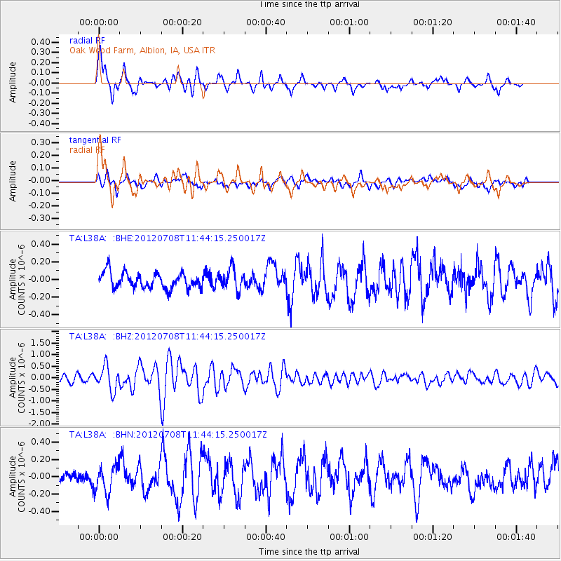
L38A Oak Wood Farm, Albion, IA, USA - Earthquake Result Viewer

| Earthquake location: |
Kuril Islands |
| Earthquake latitude/longitude: |
45.5/151.3 |
| Earthquake time(UTC): |
2012/07/08 (190) 11:33:02 GMT |
| Earthquake Depth: |
20 km |
| Earthquake Magnitude: |
5.7 MB, 5.6 MS, 6.0 MW, 5.8 MW |
| Earthquake Catalog/Contributor: |
WHDF/NEIC |
|
| Network: |
TA USArray Transportable Network (new EarthScope stations) |
| Station: |
L38A Oak Wood Farm, Albion, IA, USA |
| Lat/Lon: |
42.14 N/92.96 W |
| Elevation: |
300 m |
|
| Distance: |
75.6 deg |
| Az: |
43.745 deg |
| Baz: |
319.164 deg |
| Ray Param: |
0.051509563 |
| Estimated Moho Depth: |
35.25 km |
| Estimated Crust Vp/Vs: |
2.10 |
| Assumed Crust Vp: |
6.53 km/s |
| Estimated Crust Vs: |
3.113 km/s |
| Estimated Crust Poisson's Ratio: |
0.35 |
|
| Radial Match: |
81.00795 % |
| Radial Bump: |
387 |
| Transverse Match: |
60.94229 % |
| Transverse Bump: |
400 |
| SOD ConfigId: |
463687 |
| Insert Time: |
2013-02-20 20:22:44.238 +0000 |
| GWidth: |
2.5 |
| Max Bumps: |
400 |
| Tol: |
0.001 |
|
Signal To Noise
| Channel | StoN | STA | LTA |
| TA:L38A: :BHZ:20120708T11:44:15.250017Z | 3.3093638 | 5.334057E-7 | 1.6118072E-7 |
| TA:L38A: :BHN:20120708T11:44:15.250017Z | 1.6557375 | 1.6397941E-7 | 9.903708E-8 |
| TA:L38A: :BHE:20120708T11:44:15.250017Z | 1.387503 | 1.2146562E-7 | 8.7542595E-8 |
| Arrivals |
| Ps | 6.1 SECOND |
| PpPs | 16 SECOND |
| PsPs/PpSs | 22 SECOND |


