SSB Saint Sauveur Badole, France - Earthquake Result Viewer
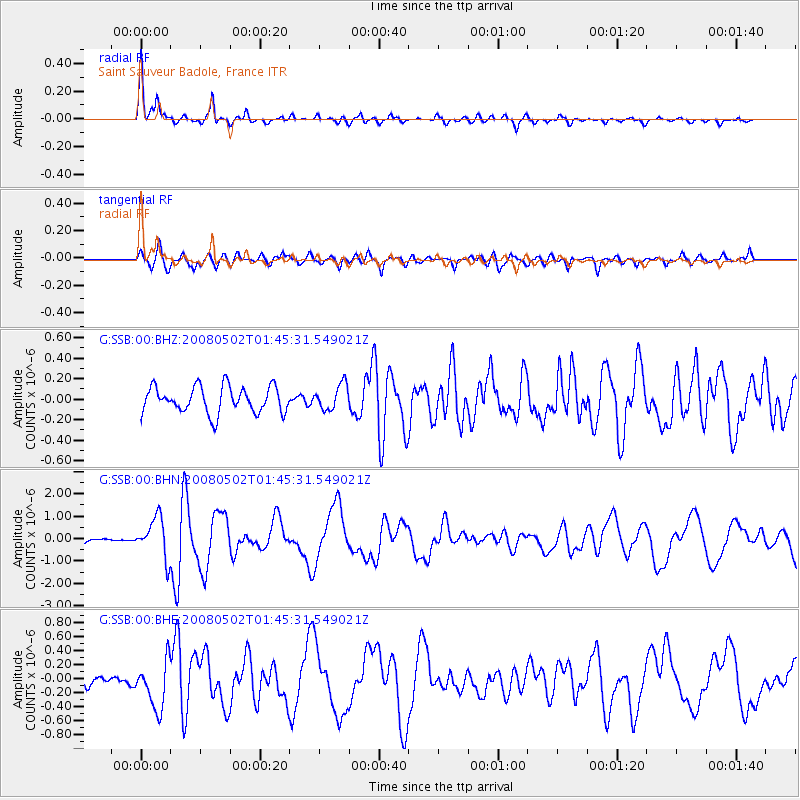
Earthquake location: Andreanof Islands, Aleutian Is.
Earthquake latitude/longitude: 51.9/-177.5
Earthquake time(UTC): 2008/05/02 (123) 01:33:37 GMT
Earthquake Depth: 14 km
Earthquake Magnitude: 6.3 MB, 6.8 MS, 6.6 MW, 6.6 MW
Earthquake Catalog/Contributor: WHDF/NEIC
Network: G GEOSCOPE
Station: SSB Saint Sauveur Badole, France
Lat/Lon: 45.28 N/4.54 E
Elevation: 700 m
Distance: 83.2 deg
Az: 358.528 deg
Baz: 1.292 deg
Ray Param: 0.046336614
Estimated Moho Depth: 29.25 km
Estimated Crust Vp/Vs: 1.60
Assumed Crust Vp: 6.1 km/s
Estimated Crust Vs: 3.812 km/s
Estimated Crust Poisson's Ratio: 0.18
Radial Match: 91.25578 %
Radial Bump: 331
Transverse Match: 78.03836 %
Transverse Bump: 400
SOD ConfigId: 2504
Insert Time: 2010-02-27 00:15:40.842 +0000
GWidth: 2.5
Max Bumps: 400
Tol: 0.001

Signal To Noise

ChannelStoNSTALTA
G:SSB:00:BHN:20080502T01:45:31.549021Z8.5283988.9774215E-71.0526505E-7
G:SSB:00:BHE:20080502T01:45:31.549021Z6.30393083.347033E-75.309438E-8
G:SSB:00:BHZ:20080502T01:45:31.549021Z0.961352171.2326336E-71.2821873E-7
Arrivals
Ps3.0 SECOND
PpPs12 SECOND
PsPs/PpSs15 SECOND