You are here: Home > Network List > GS - US Geological Survey Networks Stations List
> Station DEC12 Boyd Road Surface Site > Earthquake Result Viewer
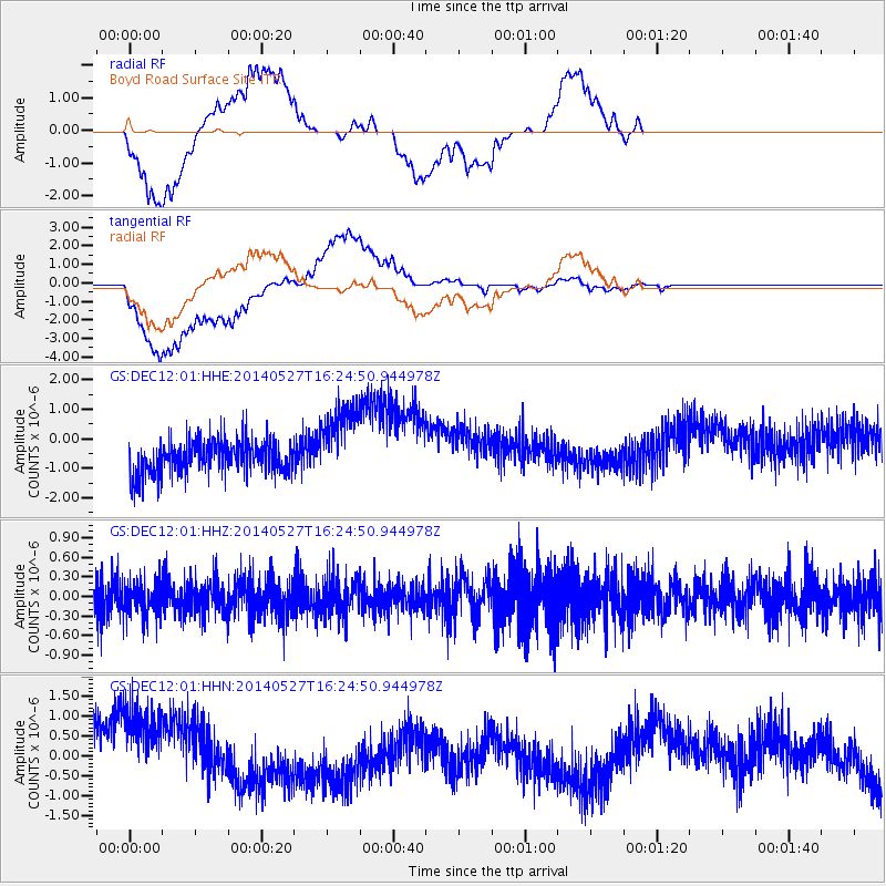
DEC12 Boyd Road Surface Site - Earthquake Result Viewer
*The percent match for this event was below the threshold and hence no stack was calculated.
| Earthquake location: |
Southeast Of Honshu, Japan |
| Earthquake latitude/longitude: |
32.5/140.7 |
| Earthquake time(UTC): |
2014/05/27 (147) 16:12:09 GMT |
| Earthquake Depth: |
74 km |
| Earthquake Magnitude: |
4.9 MW |
| Earthquake Catalog/Contributor: |
ISC/ISC |
|
| Network: |
GS US Geological Survey Networks |
| Station: |
DEC12 Boyd Road Surface Site |
| Lat/Lon: |
39.91 N/88.91 W |
| Elevation: |
208 m |
|
| Distance: |
94.6 deg |
| Az: |
35.971 deg |
| Baz: |
319.817 deg |
| Ray Param: |
$rayparam |
*The percent match for this event was below the threshold and hence was not used in the summary stack. |
|
| Radial Match: |
72.78262 % |
| Radial Bump: |
400 |
| Transverse Match: |
57.55913 % |
| Transverse Bump: |
400 |
| SOD ConfigId: |
3390531 |
| Insert Time: |
2019-04-12 01:33:56.688 +0000 |
| GWidth: |
2.5 |
| Max Bumps: |
400 |
| Tol: |
0.001 |
|
Signal To Noise
| Channel | StoN | STA | LTA |
| GS:DEC12:01:HHZ:20140527T16:24:50.944978Z | 0.73546344 | 2.6619125E-7 | 3.6193674E-7 |
| GS:DEC12:01:HHN:20140527T16:24:50.944978Z | 1.8161925 | 1.3177544E-6 | 7.255587E-7 |
| GS:DEC12:01:HHE:20140527T16:24:50.944978Z | 2.3474548 | 1.3255494E-6 | 5.6467513E-7 |
| Arrivals |
| Ps | |
| PpPs | |
| PsPs/PpSs | |


