
SSB Saint Sauveur Badole, France - Earthquake Result Viewer
| ||||||||||||||||||
| ||||||||||||||||||
| ||||||||||||||||||
|
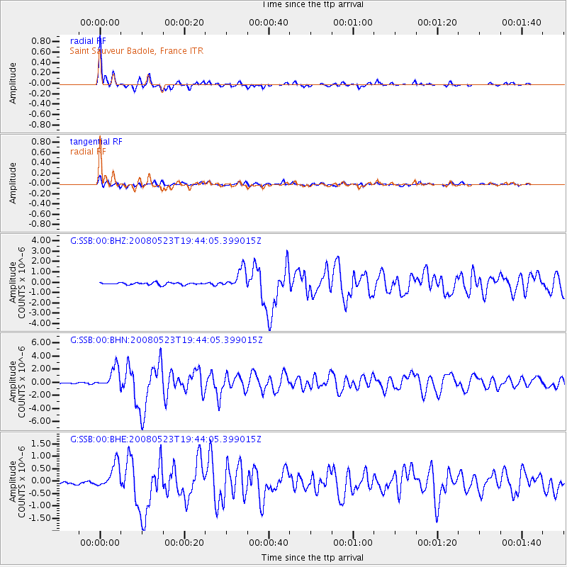
Signal To Noise
| Channel | StoN | STA | LTA |
| G:SSB:00:BHN:20080523T19:44:05.399015Z | 15.67071 | 1.5949412E-6 | 1.0177849E-7 |
| G:SSB:00:BHE:20080523T19:44:05.399015Z | 8.323504 | 5.463398E-7 | 6.563819E-8 |
| G:SSB:00:BHZ:20080523T19:44:05.399015Z | 9.458899 | 9.967506E-7 | 1.0537702E-7 |
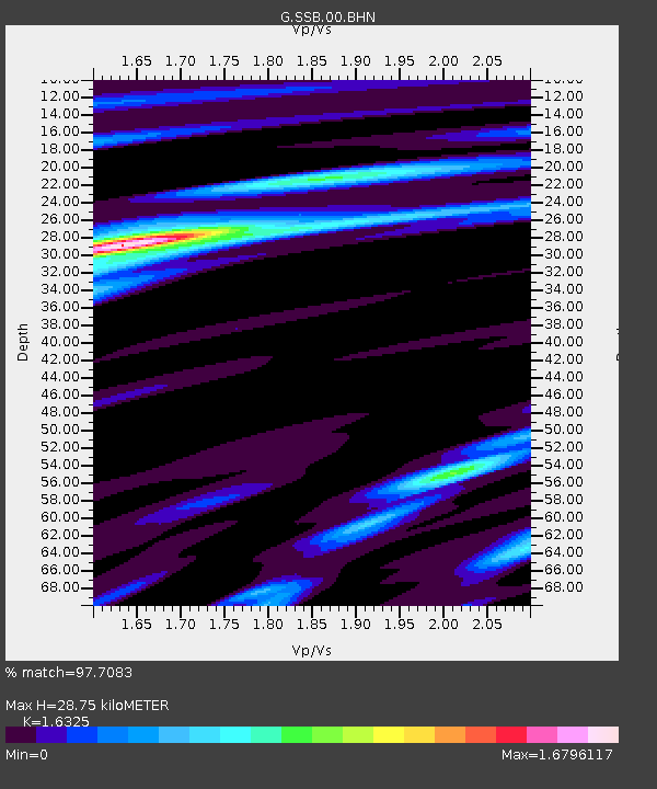
| Arrivals | |
| Ps | 3.2 SECOND |
| PpPs | 12 SECOND |
| PsPs/PpSs | 15 SECOND |

