SSB Saint Sauveur Badole, France - Earthquake Result Viewer
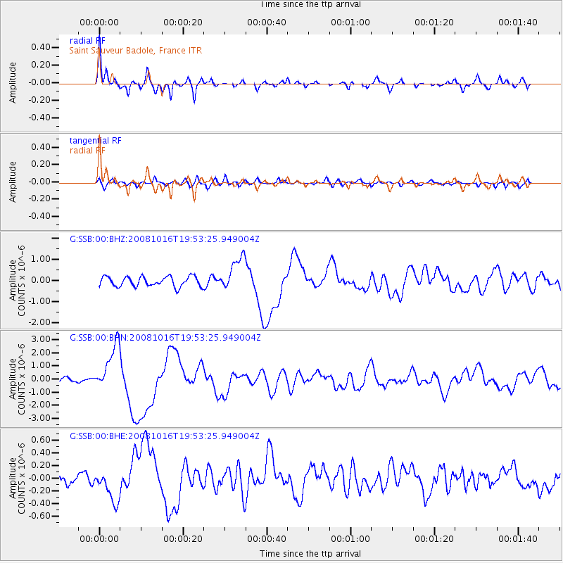
Earthquake location: Near Coast Of Chiapas, Mexico
Earthquake latitude/longitude: 14.4/-92.4
Earthquake time(UTC): 2008/10/16 (290) 19:41:25 GMT
Earthquake Depth: 24 km
Earthquake Magnitude: 6.1 MB, 6.6 MS, 6.7 MW, 6.6 MW
Earthquake Catalog/Contributor: WHDF/NEIC
Network: G GEOSCOPE
Station: SSB Saint Sauveur Badole, France
Lat/Lon: 45.28 N/4.54 E
Elevation: 700 m
Distance: 84.7 deg
Az: 44.746 deg
Baz: 284.974 deg
Ray Param: 0.04529637
Estimated Moho Depth: 25.0 km
Estimated Crust Vp/Vs: 1.89
Assumed Crust Vp: 6.1 km/s
Estimated Crust Vs: 3.223 km/s
Estimated Crust Poisson's Ratio: 0.31
Radial Match: 92.23543 %
Radial Bump: 263
Transverse Match: 69.22527 %
Transverse Bump: 400
SOD ConfigId: 2556
Insert Time: 2010-02-27 00:16:05.157 +0000
GWidth: 2.5
Max Bumps: 400
Tol: 0.001

Signal To Noise

ChannelStoNSTALTA
G:SSB:00:BHN:20081016T19:53:25.949004Z12.8310491.8585089E-61.4484465E-7
G:SSB:00:BHE:20081016T19:53:25.949004Z2.37920432.648725E-71.113282E-7
G:SSB:00:BHZ:20081016T19:53:25.949004Z3.52063548.210816E-72.3321972E-7
Arrivals
Ps3.7 SECOND
PpPs12 SECOND
PsPs/PpSs15 SECOND