You are here: Home > Network List > TA - USArray Transportable Network (new EarthScope stations) Stations List
> Station M42A Sheffield, IL, USA > Earthquake Result Viewer
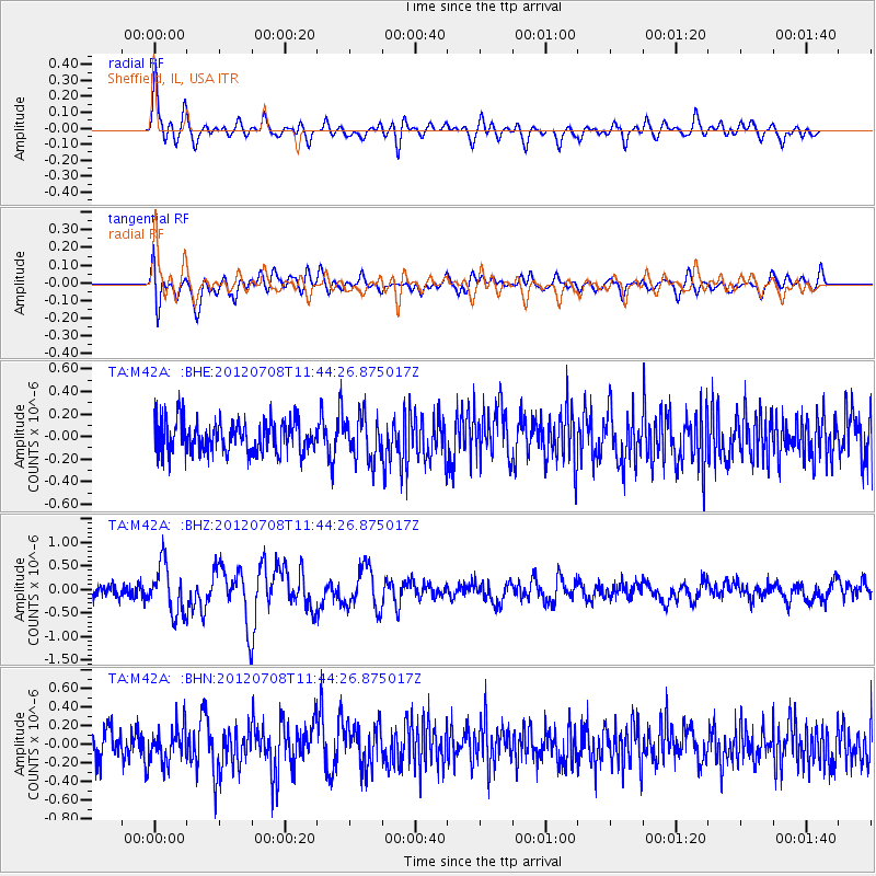
M42A Sheffield, IL, USA - Earthquake Result Viewer
*The percent match for this event was below the threshold and hence no stack was calculated.
| Earthquake location: |
Kuril Islands |
| Earthquake latitude/longitude: |
45.5/151.3 |
| Earthquake time(UTC): |
2012/07/08 (190) 11:33:02 GMT |
| Earthquake Depth: |
20 km |
| Earthquake Magnitude: |
5.7 MB, 5.6 MS, 6.0 MW, 5.8 MW |
| Earthquake Catalog/Contributor: |
WHDF/NEIC |
|
| Network: |
TA USArray Transportable Network (new EarthScope stations) |
| Station: |
M42A Sheffield, IL, USA |
| Lat/Lon: |
41.45 N/89.76 W |
| Elevation: |
212 m |
|
| Distance: |
77.7 deg |
| Az: |
42.311 deg |
| Baz: |
320.96 deg |
| Ray Param: |
$rayparam |
*The percent match for this event was below the threshold and hence was not used in the summary stack. |
|
| Radial Match: |
68.01388 % |
| Radial Bump: |
400 |
| Transverse Match: |
71.964386 % |
| Transverse Bump: |
400 |
| SOD ConfigId: |
463687 |
| Insert Time: |
2013-02-20 20:43:08.370 +0000 |
| GWidth: |
2.5 |
| Max Bumps: |
400 |
| Tol: |
0.001 |
|
Signal To Noise
| Channel | StoN | STA | LTA |
| TA:M42A: :BHZ:20120708T11:44:26.875017Z | 4.222591 | 5.182434E-7 | 1.2273114E-7 |
| TA:M42A: :BHN:20120708T11:44:26.875017Z | 1.3655951 | 1.8049505E-7 | 1.3217318E-7 |
| TA:M42A: :BHE:20120708T11:44:26.875017Z | 1.3945729 | 1.9400106E-7 | 1.3911146E-7 |
| Arrivals |
| Ps | |
| PpPs | |
| PsPs/PpSs | |


