You are here: Home > Network List > TA - USArray Transportable Network (new EarthScope stations) Stations List
> Station N23A Red Feather Lakes, CO, USA > Earthquake Result Viewer
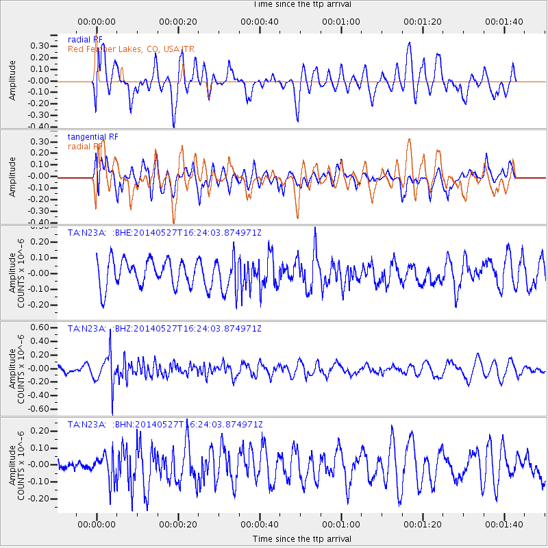
N23A Red Feather Lakes, CO, USA - Earthquake Result Viewer
*The percent match for this event was below the threshold and hence no stack was calculated.
| Earthquake location: |
Southeast Of Honshu, Japan |
| Earthquake latitude/longitude: |
32.5/140.7 |
| Earthquake time(UTC): |
2014/05/27 (147) 16:12:09 GMT |
| Earthquake Depth: |
74 km |
| Earthquake Magnitude: |
4.9 MW |
| Earthquake Catalog/Contributor: |
ISC/ISC |
|
| Network: |
TA USArray Transportable Network (new EarthScope stations) |
| Station: |
N23A Red Feather Lakes, CO, USA |
| Lat/Lon: |
40.89 N/105.94 W |
| Elevation: |
2458 m |
|
| Distance: |
84.6 deg |
| Az: |
44.338 deg |
| Baz: |
308.832 deg |
| Ray Param: |
$rayparam |
*The percent match for this event was below the threshold and hence was not used in the summary stack. |
|
| Radial Match: |
54.38654 % |
| Radial Bump: |
400 |
| Transverse Match: |
55.49239 % |
| Transverse Bump: |
400 |
| SOD ConfigId: |
3390531 |
| Insert Time: |
2019-04-12 01:36:57.652 +0000 |
| GWidth: |
2.5 |
| Max Bumps: |
400 |
| Tol: |
0.001 |
|
Signal To Noise
| Channel | StoN | STA | LTA |
| TA:N23A: :BHZ:20140527T16:24:03.874971Z | 3.4411645 | 2.2918773E-7 | 6.660179E-8 |
| TA:N23A: :BHN:20140527T16:24:03.874971Z | 0.7126887 | 7.906401E-8 | 1.1093764E-7 |
| TA:N23A: :BHE:20140527T16:24:03.874971Z | 1.3430113 | 1.1157585E-7 | 8.307886E-8 |
| Arrivals |
| Ps | |
| PpPs | |
| PsPs/PpSs | |


