You are here: Home > Network List > TA - USArray Transportable Network (new EarthScope stations) Stations List
> Station Q24A Divide, CO, USA > Earthquake Result Viewer
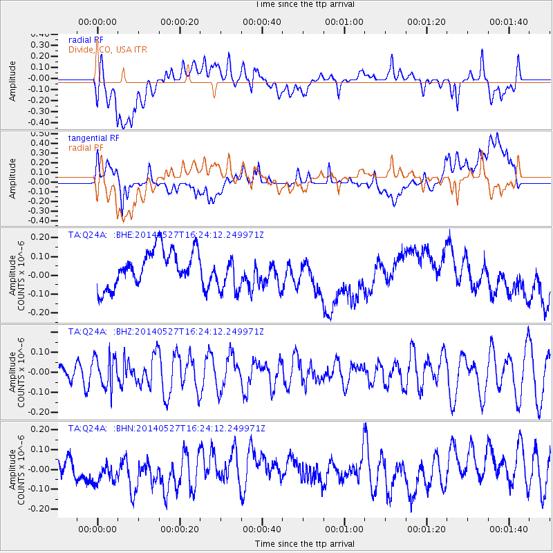
Q24A Divide, CO, USA - Earthquake Result Viewer
*The percent match for this event was below the threshold and hence no stack was calculated.
| Earthquake location: |
Southeast Of Honshu, Japan |
| Earthquake latitude/longitude: |
32.5/140.7 |
| Earthquake time(UTC): |
2014/05/27 (147) 16:12:09 GMT |
| Earthquake Depth: |
74 km |
| Earthquake Magnitude: |
4.9 MW |
| Earthquake Catalog/Contributor: |
ISC/ISC |
|
| Network: |
TA USArray Transportable Network (new EarthScope stations) |
| Station: |
Q24A Divide, CO, USA |
| Lat/Lon: |
38.96 N/105.15 W |
| Elevation: |
2775 m |
|
| Distance: |
86.3 deg |
| Az: |
45.452 deg |
| Baz: |
309.429 deg |
| Ray Param: |
$rayparam |
*The percent match for this event was below the threshold and hence was not used in the summary stack. |
|
| Radial Match: |
39.63772 % |
| Radial Bump: |
400 |
| Transverse Match: |
35.58327 % |
| Transverse Bump: |
400 |
| SOD ConfigId: |
3390531 |
| Insert Time: |
2019-04-12 01:37:03.859 +0000 |
| GWidth: |
2.5 |
| Max Bumps: |
400 |
| Tol: |
0.001 |
|
Signal To Noise
| Channel | StoN | STA | LTA |
| TA:Q24A: :BHZ:20140527T16:24:12.249971Z | 1.273984 | 8.008062E-8 | 6.285842E-8 |
| TA:Q24A: :BHN:20140527T16:24:12.249971Z | 1.1503797 | 6.960344E-8 | 6.050475E-8 |
| TA:Q24A: :BHE:20140527T16:24:12.249971Z | 1.1005354 | 1.0363968E-7 | 9.417206E-8 |
| Arrivals |
| Ps | |
| PpPs | |
| PsPs/PpSs | |


