You are here: Home > Network List > US - United States National Seismic Network Stations List
> Station LAO LASA Array, Montana, USA > Earthquake Result Viewer
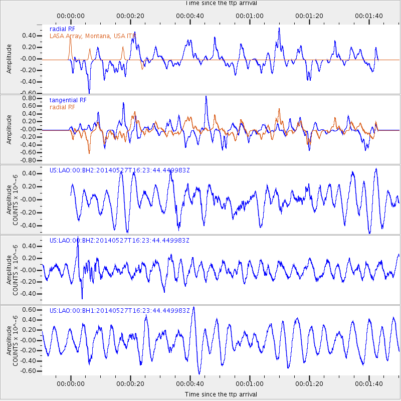
LAO LASA Array, Montana, USA - Earthquake Result Viewer
*The percent match for this event was below the threshold and hence no stack was calculated.
| Earthquake location: |
Southeast Of Honshu, Japan |
| Earthquake latitude/longitude: |
32.5/140.7 |
| Earthquake time(UTC): |
2014/05/27 (147) 16:12:09 GMT |
| Earthquake Depth: |
74 km |
| Earthquake Magnitude: |
4.9 MW |
| Earthquake Catalog/Contributor: |
ISC/ISC |
|
| Network: |
US United States National Seismic Network |
| Station: |
LAO LASA Array, Montana, USA |
| Lat/Lon: |
46.69 N/106.22 W |
| Elevation: |
902 m |
|
| Distance: |
80.8 deg |
| Az: |
39.893 deg |
| Baz: |
308.073 deg |
| Ray Param: |
$rayparam |
*The percent match for this event was below the threshold and hence was not used in the summary stack. |
|
| Radial Match: |
41.6794 % |
| Radial Bump: |
400 |
| Transverse Match: |
53.68074 % |
| Transverse Bump: |
400 |
| SOD ConfigId: |
3390531 |
| Insert Time: |
2019-04-12 01:37:33.760 +0000 |
| GWidth: |
2.5 |
| Max Bumps: |
400 |
| Tol: |
0.001 |
|
Signal To Noise
| Channel | StoN | STA | LTA |
| US:LAO:00:BHZ:20140527T16:23:44.449983Z | 2.8656917 | 2.1610269E-7 | 7.5410306E-8 |
| US:LAO:00:BH1:20140527T16:23:44.449983Z | 0.92353797 | 1.7768379E-7 | 1.9239468E-7 |
| US:LAO:00:BH2:20140527T16:23:44.449983Z | 0.99292094 | 2.154914E-7 | 2.1702775E-7 |
| Arrivals |
| Ps | |
| PpPs | |
| PsPs/PpSs | |


