You are here: Home > Network List > TA - USArray Transportable Network (new EarthScope stations) Stations List
> Station P44A Sand Creek, Windsor, IL, USA > Earthquake Result Viewer
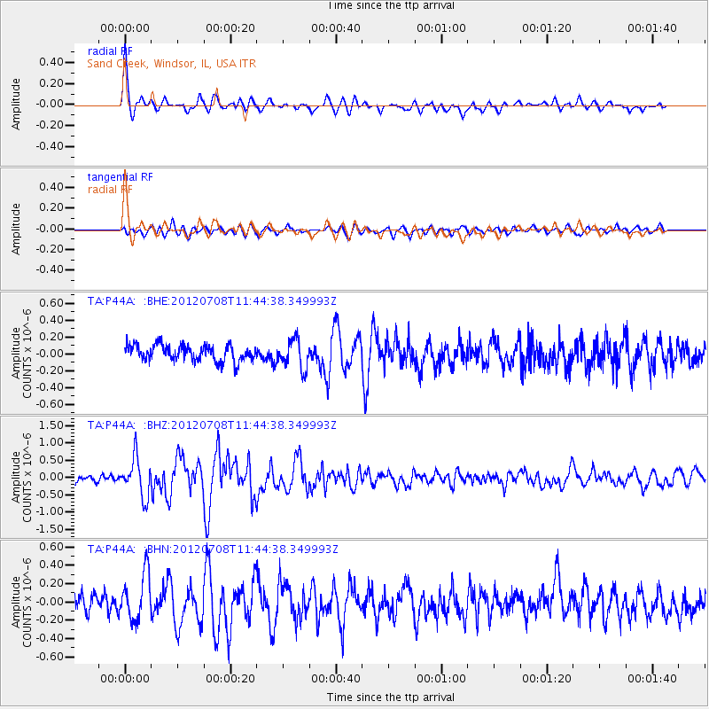
P44A Sand Creek, Windsor, IL, USA - Earthquake Result Viewer
*The percent match for this event was below the threshold and hence no stack was calculated.
| Earthquake location: |
Kuril Islands |
| Earthquake latitude/longitude: |
45.5/151.3 |
| Earthquake time(UTC): |
2012/07/08 (190) 11:33:02 GMT |
| Earthquake Depth: |
20 km |
| Earthquake Magnitude: |
5.7 MB, 5.6 MS, 6.0 MW, 5.8 MW |
| Earthquake Catalog/Contributor: |
WHDF/NEIC |
|
| Network: |
TA USArray Transportable Network (new EarthScope stations) |
| Station: |
P44A Sand Creek, Windsor, IL, USA |
| Lat/Lon: |
39.47 N/88.62 W |
| Elevation: |
195 m |
|
| Distance: |
79.8 deg |
| Az: |
42.883 deg |
| Baz: |
321.807 deg |
| Ray Param: |
$rayparam |
*The percent match for this event was below the threshold and hence was not used in the summary stack. |
|
| Radial Match: |
79.69154 % |
| Radial Bump: |
400 |
| Transverse Match: |
69.18816 % |
| Transverse Bump: |
400 |
| SOD ConfigId: |
466652 |
| Insert Time: |
2013-02-21 01:10:26.223 +0000 |
| GWidth: |
2.5 |
| Max Bumps: |
400 |
| Tol: |
0.001 |
|
Signal To Noise
| Channel | StoN | STA | LTA |
| TA:P44A: :BHZ:20120708T11:44:38.349993Z | 5.9643846 | 5.61046E-7 | 9.406603E-8 |
| TA:P44A: :BHN:20120708T11:44:38.349993Z | 2.6056345 | 2.5969757E-7 | 9.9667695E-8 |
| TA:P44A: :BHE:20120708T11:44:38.349993Z | 1.8046521 | 1.7169253E-7 | 9.513886E-8 |
| Arrivals |
| Ps | |
| PpPs | |
| PsPs/PpSs | |


