You are here: Home > Network List > TA - USArray Transportable Network (new EarthScope stations) Stations List
> Station I39A Houston, MN, USA > Earthquake Result Viewer
I39A Houston, MN, USA - Earthquake Result Viewer

| Earthquake location: |
Kuril Islands |
| Earthquake latitude/longitude: |
45.5/151.3 |
| Earthquake time(UTC): |
2012/07/08 (190) 11:33:02 GMT |
| Earthquake Depth: |
20 km |
| Earthquake Magnitude: |
5.7 MB, 5.6 MS, 6.0 MW, 5.8 MW |
| Earthquake Catalog/Contributor: |
WHDF/NEIC |
|
| Network: |
TA USArray Transportable Network (new EarthScope stations) |
| Station: |
I39A Houston, MN, USA |
| Lat/Lon: |
43.85 N/91.52 W |
| Elevation: |
393 m |
|
| Distance: |
75.0 deg |
| Az: |
41.766 deg |
| Baz: |
319.639 deg |
| Ray Param: |
0.051918093 |
| Estimated Moho Depth: |
61.75 km |
| Estimated Crust Vp/Vs: |
1.81 |
| Assumed Crust Vp: |
6.53 km/s |
| Estimated Crust Vs: |
3.603 km/s |
| Estimated Crust Poisson's Ratio: |
0.28 |
|
| Radial Match: |
84.09908 % |
| Radial Bump: |
400 |
| Transverse Match: |
67.8801 % |
| Transverse Bump: |
400 |
| SOD ConfigId: |
466652 |
| Insert Time: |
2013-02-21 01:10:49.834 +0000 |
| GWidth: |
2.5 |
| Max Bumps: |
400 |
| Tol: |
0.001 |
|
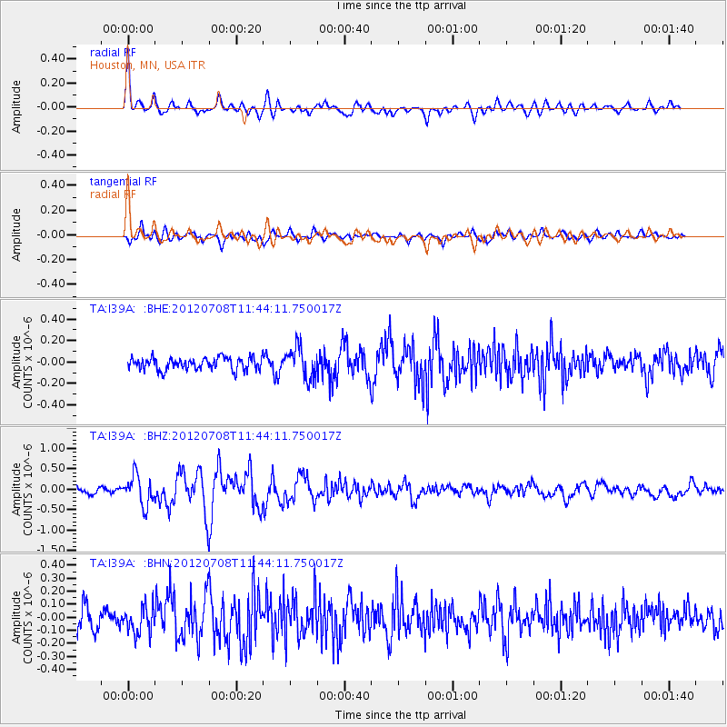
Signal To Noise
| Channel | StoN | STA | LTA |
| TA:I39A: :BHZ:20120708T11:44:11.750017Z | 4.8629074 | 3.7005663E-7 | 7.609781E-8 |
| TA:I39A: :BHN:20120708T11:44:11.750017Z | 1.0868826 | 1.02265496E-7 | 9.409065E-8 |
| TA:I39A: :BHE:20120708T11:44:11.750017Z | 2.6046565 | 1.4674512E-7 | 5.6339534E-8 |
| Arrivals |
| Ps | 7.9 SECOND |
| PpPs | 26 SECOND |
| PsPs/PpSs | 34 SECOND |


