You are here: Home > Network List > TA - USArray Transportable Network (new EarthScope stations) Stations List
> Station O47A Sheridan, IN, USA > Earthquake Result Viewer
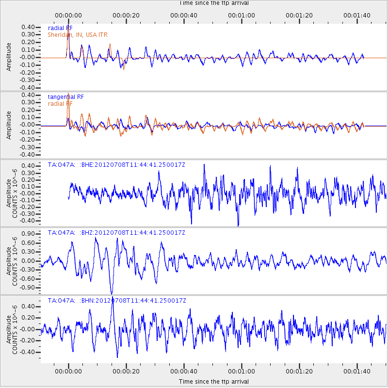
O47A Sheridan, IN, USA - Earthquake Result Viewer
*The percent match for this event was below the threshold and hence no stack was calculated.
| Earthquake location: |
Kuril Islands |
| Earthquake latitude/longitude: |
45.5/151.3 |
| Earthquake time(UTC): |
2012/07/08 (190) 11:33:02 GMT |
| Earthquake Depth: |
20 km |
| Earthquake Magnitude: |
5.7 MB, 5.6 MS, 6.0 MW, 5.8 MW |
| Earthquake Catalog/Contributor: |
WHDF/NEIC |
|
| Network: |
TA USArray Transportable Network (new EarthScope stations) |
| Station: |
O47A Sheridan, IN, USA |
| Lat/Lon: |
40.24 N/86.17 W |
| Elevation: |
278 m |
|
| Distance: |
80.3 deg |
| Az: |
40.893 deg |
| Baz: |
323.025 deg |
| Ray Param: |
$rayparam |
*The percent match for this event was below the threshold and hence was not used in the summary stack. |
|
| Radial Match: |
72.51899 % |
| Radial Bump: |
400 |
| Transverse Match: |
64.95308 % |
| Transverse Bump: |
400 |
| SOD ConfigId: |
466652 |
| Insert Time: |
2013-02-21 01:20:50.798 +0000 |
| GWidth: |
2.5 |
| Max Bumps: |
400 |
| Tol: |
0.001 |
|
Signal To Noise
| Channel | StoN | STA | LTA |
| TA:O47A: :BHZ:20120708T11:44:41.250017Z | 3.9779227 | 3.7142544E-7 | 9.33717E-8 |
| TA:O47A: :BHN:20120708T11:44:41.250017Z | 1.7899077 | 1.395774E-7 | 7.798022E-8 |
| TA:O47A: :BHE:20120708T11:44:41.250017Z | 2.2736104 | 1.3475382E-7 | 5.9268654E-8 |
| Arrivals |
| Ps | |
| PpPs | |
| PsPs/PpSs | |


