You are here: Home > Network List > TA - USArray Transportable Network (new EarthScope stations) Stations List
> Station Z45A Winona, MS, USA > Earthquake Result Viewer
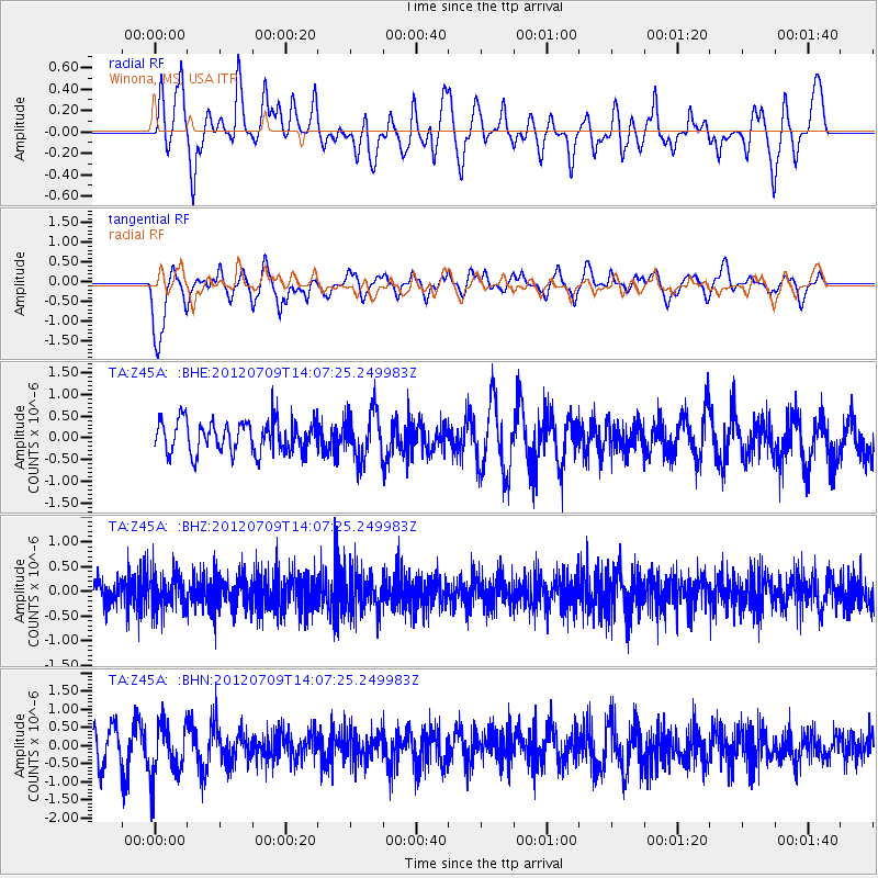
Z45A Winona, MS, USA - Earthquake Result Viewer
*The percent match for this event was below the threshold and hence no stack was calculated.
| Earthquake location: |
Eastern Mediterranean Sea |
| Earthquake latitude/longitude: |
35.6/28.9 |
| Earthquake time(UTC): |
2012/07/09 (191) 13:55:00 GMT |
| Earthquake Depth: |
56 km |
| Earthquake Magnitude: |
5.6 MB, 5.6 MW, 5.6 MW |
| Earthquake Catalog/Contributor: |
WHDF/NEIC |
|
| Network: |
TA USArray Transportable Network (new EarthScope stations) |
| Station: |
Z45A Winona, MS, USA |
| Lat/Lon: |
33.37 N/89.69 W |
| Elevation: |
113 m |
|
| Distance: |
90.5 deg |
| Az: |
312.72 deg |
| Baz: |
45.679 deg |
| Ray Param: |
$rayparam |
*The percent match for this event was below the threshold and hence was not used in the summary stack. |
|
| Radial Match: |
59.965786 % |
| Radial Bump: |
400 |
| Transverse Match: |
65.590065 % |
| Transverse Bump: |
400 |
| SOD ConfigId: |
466652 |
| Insert Time: |
2013-02-21 02:56:57.640 +0000 |
| GWidth: |
2.5 |
| Max Bumps: |
400 |
| Tol: |
0.001 |
|
Signal To Noise
| Channel | StoN | STA | LTA |
| TA:Z45A: :BHZ:20120709T14:07:25.249983Z | 2.0500395 | 3.555192E-7 | 1.7342064E-7 |
| TA:Z45A: :BHN:20120709T14:07:25.249983Z | 1.5454928 | 7.337557E-7 | 4.7477135E-7 |
| TA:Z45A: :BHE:20120709T14:07:25.249983Z | 1.5077016 | 5.4378864E-7 | 3.6067388E-7 |
| Arrivals |
| Ps | |
| PpPs | |
| PsPs/PpSs | |


