You are here: Home > Network List > TA - USArray Transportable Network (new EarthScope stations) Stations List
> Station 154A Montrose, GA, USA > Earthquake Result Viewer
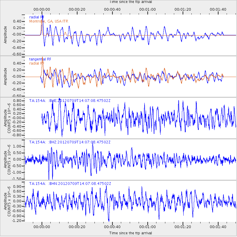
154A Montrose, GA, USA - Earthquake Result Viewer
*The percent match for this event was below the threshold and hence no stack was calculated.
| Earthquake location: |
Eastern Mediterranean Sea |
| Earthquake latitude/longitude: |
35.6/28.9 |
| Earthquake time(UTC): |
2012/07/09 (191) 13:55:00 GMT |
| Earthquake Depth: |
56 km |
| Earthquake Magnitude: |
5.6 MB, 5.6 MW, 5.6 MW |
| Earthquake Catalog/Contributor: |
WHDF/NEIC |
|
| Network: |
TA USArray Transportable Network (new EarthScope stations) |
| Station: |
154A Montrose, GA, USA |
| Lat/Lon: |
32.61 N/83.11 W |
| Elevation: |
111 m |
|
| Distance: |
87.0 deg |
| Az: |
308.421 deg |
| Baz: |
49.156 deg |
| Ray Param: |
$rayparam |
*The percent match for this event was below the threshold and hence was not used in the summary stack. |
|
| Radial Match: |
57.69983 % |
| Radial Bump: |
400 |
| Transverse Match: |
52.562305 % |
| Transverse Bump: |
400 |
| SOD ConfigId: |
466652 |
| Insert Time: |
2013-02-21 03:04:39.951 +0000 |
| GWidth: |
2.5 |
| Max Bumps: |
400 |
| Tol: |
0.001 |
|
Signal To Noise
| Channel | StoN | STA | LTA |
| TA:154A: :BHZ:20120709T14:07:08.47502Z | 3.2520568 | 3.9436503E-7 | 1.2126634E-7 |
| TA:154A: :BHN:20120709T14:07:08.47502Z | 0.84719604 | 2.0681756E-7 | 2.441201E-7 |
| TA:154A: :BHE:20120709T14:07:08.47502Z | 0.8001891 | 3.017572E-7 | 3.7710737E-7 |
| Arrivals |
| Ps | |
| PpPs | |
| PsPs/PpSs | |


