You are here: Home > Network List > TA - USArray Transportable Network (new EarthScope stations) Stations List
> Station J01D Myrtle Point, OR, USA > Earthquake Result Viewer
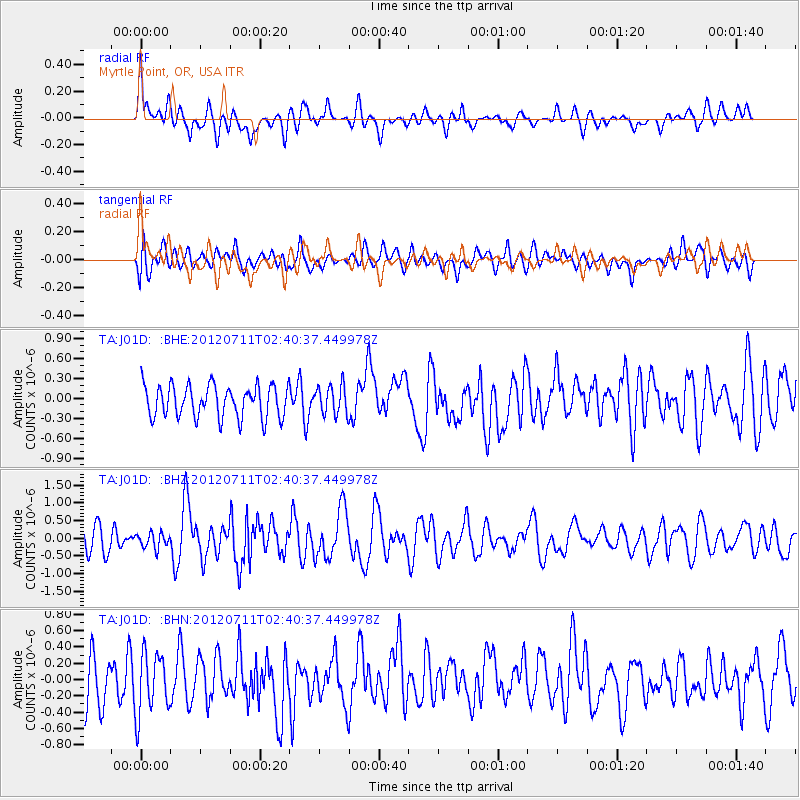
J01D Myrtle Point, OR, USA - Earthquake Result Viewer
*The percent match for this event was below the threshold and hence no stack was calculated.
| Earthquake location: |
Kuril Islands |
| Earthquake latitude/longitude: |
45.4/151.4 |
| Earthquake time(UTC): |
2012/07/11 (193) 02:31:16 GMT |
| Earthquake Depth: |
10 km |
| Earthquake Magnitude: |
5.6 MB, 5.5 MS, 5.7 MW, 5.7 MW |
| Earthquake Catalog/Contributor: |
WHDF/NEIC |
|
| Network: |
TA USArray Transportable Network (new EarthScope stations) |
| Station: |
J01D Myrtle Point, OR, USA |
| Lat/Lon: |
43.16 N/123.93 W |
| Elevation: |
131 m |
|
| Distance: |
57.9 deg |
| Az: |
59.348 deg |
| Baz: |
304.074 deg |
| Ray Param: |
$rayparam |
*The percent match for this event was below the threshold and hence was not used in the summary stack. |
|
| Radial Match: |
61.681267 % |
| Radial Bump: |
400 |
| Transverse Match: |
53.57695 % |
| Transverse Bump: |
400 |
| SOD ConfigId: |
466652 |
| Insert Time: |
2013-02-21 14:10:47.578 +0000 |
| GWidth: |
2.5 |
| Max Bumps: |
400 |
| Tol: |
0.001 |
|
Signal To Noise
| Channel | StoN | STA | LTA |
| TA:J01D: :BHZ:20120711T02:40:37.449978Z | 0.7605563 | 2.1029932E-7 | 2.7650725E-7 |
| TA:J01D: :BHN:20120711T02:40:37.449978Z | 1.4799737 | 3.806707E-7 | 2.572145E-7 |
| TA:J01D: :BHE:20120711T02:40:37.449978Z | 0.89740354 | 2.1565708E-7 | 2.4031226E-7 |
| Arrivals |
| Ps | |
| PpPs | |
| PsPs/PpSs | |


