You are here: Home > Network List > TA - USArray Transportable Network (new EarthScope stations) Stations List
> Station K37A Belmond, IA, USA > Earthquake Result Viewer
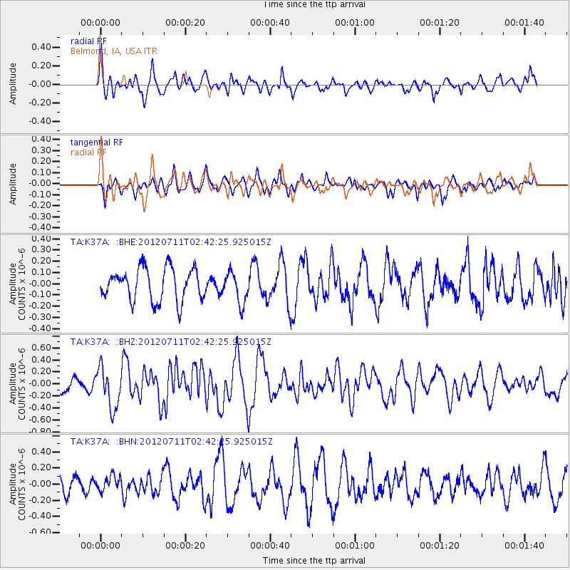
K37A Belmond, IA, USA - Earthquake Result Viewer
*The percent match for this event was below the threshold and hence no stack was calculated.
| Earthquake location: |
Kuril Islands |
| Earthquake latitude/longitude: |
45.4/151.4 |
| Earthquake time(UTC): |
2012/07/11 (193) 02:31:16 GMT |
| Earthquake Depth: |
10 km |
| Earthquake Magnitude: |
5.6 MB, 5.5 MS, 5.7 MW, 5.7 MW |
| Earthquake Catalog/Contributor: |
WHDF/NEIC |
|
| Network: |
TA USArray Transportable Network (new EarthScope stations) |
| Station: |
K37A Belmond, IA, USA |
| Lat/Lon: |
42.77 N/93.64 W |
| Elevation: |
365 m |
|
| Distance: |
74.8 deg |
| Az: |
43.772 deg |
| Baz: |
318.558 deg |
| Ray Param: |
$rayparam |
*The percent match for this event was below the threshold and hence was not used in the summary stack. |
|
| Radial Match: |
66.54153 % |
| Radial Bump: |
389 |
| Transverse Match: |
67.27502 % |
| Transverse Bump: |
400 |
| SOD ConfigId: |
466652 |
| Insert Time: |
2013-02-21 14:13:47.643 +0000 |
| GWidth: |
2.5 |
| Max Bumps: |
400 |
| Tol: |
0.001 |
|
Signal To Noise
| Channel | StoN | STA | LTA |
| TA:K37A: :BHZ:20120711T02:42:25.925015Z | 2.5006502 | 3.4542285E-7 | 1.3813322E-7 |
| TA:K37A: :BHN:20120711T02:42:25.925015Z | 0.79325676 | 9.317628E-8 | 1.1746043E-7 |
| TA:K37A: :BHE:20120711T02:42:25.925015Z | 0.9995339 | 1.438095E-7 | 1.4387656E-7 |
| Arrivals |
| Ps | |
| PpPs | |
| PsPs/PpSs | |


