You are here: Home > Network List > TA - USArray Transportable Network (new EarthScope stations) Stations List
> Station M36A Felix, Anita, IA, USA > Earthquake Result Viewer
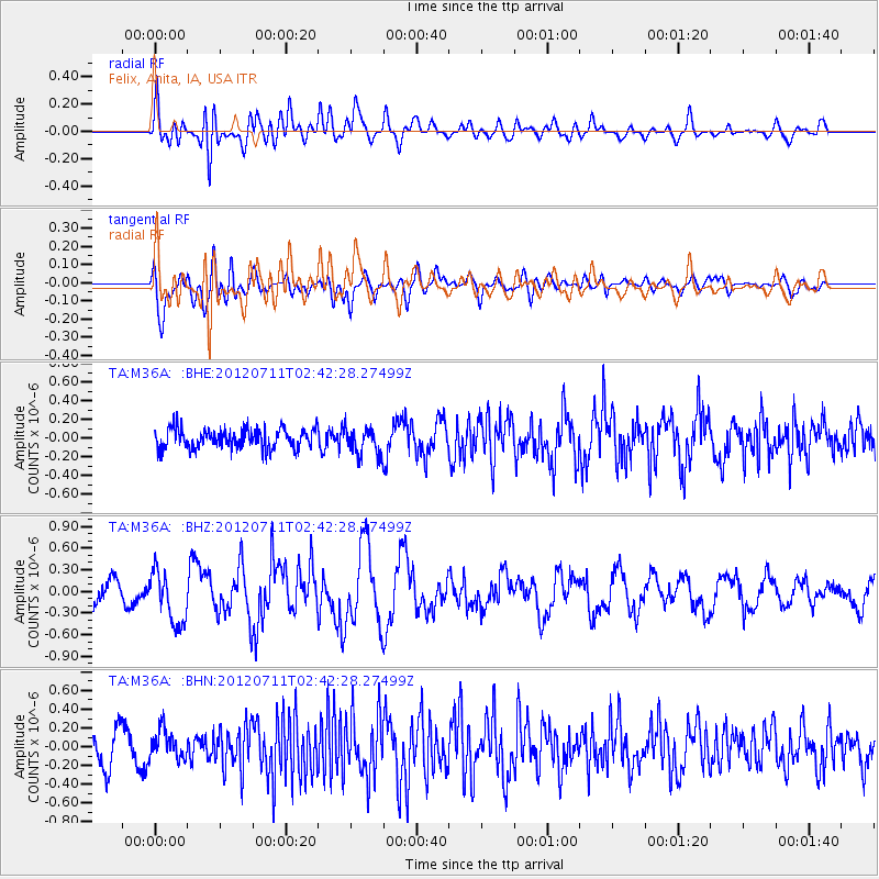
M36A Felix, Anita, IA, USA - Earthquake Result Viewer
*The percent match for this event was below the threshold and hence no stack was calculated.
| Earthquake location: |
Kuril Islands |
| Earthquake latitude/longitude: |
45.4/151.4 |
| Earthquake time(UTC): |
2012/07/11 (193) 02:31:16 GMT |
| Earthquake Depth: |
10 km |
| Earthquake Magnitude: |
5.6 MB, 5.5 MS, 5.7 MW, 5.7 MW |
| Earthquake Catalog/Contributor: |
WHDF/NEIC |
|
| Network: |
TA USArray Transportable Network (new EarthScope stations) |
| Station: |
M36A Felix, Anita, IA, USA |
| Lat/Lon: |
41.45 N/94.80 W |
| Elevation: |
430 m |
|
| Distance: |
75.3 deg |
| Az: |
45.344 deg |
| Baz: |
318.187 deg |
| Ray Param: |
$rayparam |
*The percent match for this event was below the threshold and hence was not used in the summary stack. |
|
| Radial Match: |
72.436676 % |
| Radial Bump: |
400 |
| Transverse Match: |
67.40106 % |
| Transverse Bump: |
400 |
| SOD ConfigId: |
466652 |
| Insert Time: |
2013-02-21 14:14:14.557 +0000 |
| GWidth: |
2.5 |
| Max Bumps: |
400 |
| Tol: |
0.001 |
|
Signal To Noise
| Channel | StoN | STA | LTA |
| TA:M36A: :BHZ:20120711T02:42:28.27499Z | 2.488108 | 3.635542E-7 | 1.4611673E-7 |
| TA:M36A: :BHN:20120711T02:42:28.27499Z | 1.0155902 | 1.5368447E-7 | 1.5132527E-7 |
| TA:M36A: :BHE:20120711T02:42:28.27499Z | 1.4028156 | 1.4810018E-7 | 1.0557352E-7 |
| Arrivals |
| Ps | |
| PpPs | |
| PsPs/PpSs | |


