You are here: Home > Network List > TA - USArray Transportable Network (new EarthScope stations) Stations List
> Station K40A Colesburg, IA, USA > Earthquake Result Viewer
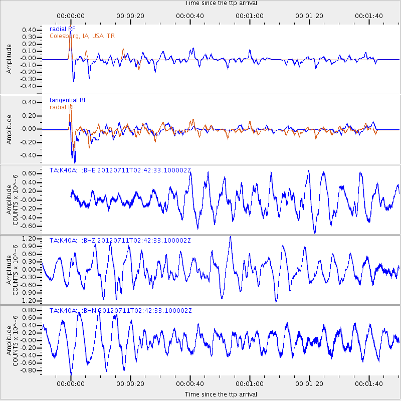
K40A Colesburg, IA, USA - Earthquake Result Viewer
*The percent match for this event was below the threshold and hence no stack was calculated.
| Earthquake location: |
Kuril Islands |
| Earthquake latitude/longitude: |
45.4/151.4 |
| Earthquake time(UTC): |
2012/07/11 (193) 02:31:16 GMT |
| Earthquake Depth: |
10 km |
| Earthquake Magnitude: |
5.6 MB, 5.5 MS, 5.7 MW, 5.7 MW |
| Earthquake Catalog/Contributor: |
WHDF/NEIC |
|
| Network: |
TA USArray Transportable Network (new EarthScope stations) |
| Station: |
K40A Colesburg, IA, USA |
| Lat/Lon: |
42.70 N/91.14 W |
| Elevation: |
274 m |
|
| Distance: |
76.1 deg |
| Az: |
42.376 deg |
| Baz: |
319.899 deg |
| Ray Param: |
$rayparam |
*The percent match for this event was below the threshold and hence was not used in the summary stack. |
|
| Radial Match: |
76.12222 % |
| Radial Bump: |
400 |
| Transverse Match: |
81.23474 % |
| Transverse Bump: |
400 |
| SOD ConfigId: |
466652 |
| Insert Time: |
2013-02-21 14:20:06.219 +0000 |
| GWidth: |
2.5 |
| Max Bumps: |
400 |
| Tol: |
0.001 |
|
Signal To Noise
| Channel | StoN | STA | LTA |
| TA:K40A: :BHZ:20120711T02:42:33.100002Z | 1.6878003 | 4.2386782E-7 | 2.5113624E-7 |
| TA:K40A: :BHN:20120711T02:42:33.100002Z | 2.1517918 | 5.290985E-7 | 2.4588738E-7 |
| TA:K40A: :BHE:20120711T02:42:33.100002Z | 1.7624028 | 1.7177365E-7 | 9.746561E-8 |
| Arrivals |
| Ps | |
| PpPs | |
| PsPs/PpSs | |


