You are here: Home > Network List > TA - USArray Transportable Network (new EarthScope stations) Stations List
> Station J41A Loganville, WI, USA > Earthquake Result Viewer
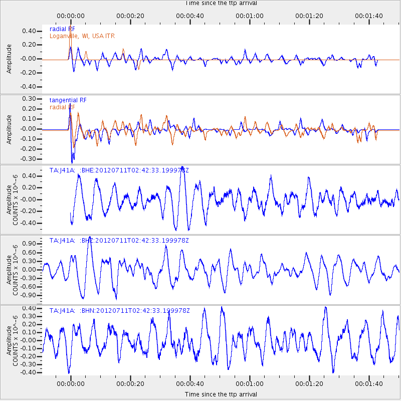
J41A Loganville, WI, USA - Earthquake Result Viewer
*The percent match for this event was below the threshold and hence no stack was calculated.
| Earthquake location: |
Kuril Islands |
| Earthquake latitude/longitude: |
45.4/151.4 |
| Earthquake time(UTC): |
2012/07/11 (193) 02:31:16 GMT |
| Earthquake Depth: |
10 km |
| Earthquake Magnitude: |
5.6 MB, 5.5 MS, 5.7 MW, 5.7 MW |
| Earthquake Catalog/Contributor: |
WHDF/NEIC |
|
| Network: |
TA USArray Transportable Network (new EarthScope stations) |
| Station: |
J41A Loganville, WI, USA |
| Lat/Lon: |
43.37 N/90.01 W |
| Elevation: |
360 m |
|
| Distance: |
76.1 deg |
| Az: |
41.285 deg |
| Baz: |
320.402 deg |
| Ray Param: |
$rayparam |
*The percent match for this event was below the threshold and hence was not used in the summary stack. |
|
| Radial Match: |
57.01174 % |
| Radial Bump: |
400 |
| Transverse Match: |
79.27891 % |
| Transverse Bump: |
400 |
| SOD ConfigId: |
466652 |
| Insert Time: |
2013-02-21 14:20:53.526 +0000 |
| GWidth: |
2.5 |
| Max Bumps: |
400 |
| Tol: |
0.001 |
|
Signal To Noise
| Channel | StoN | STA | LTA |
| TA:J41A: :BHZ:20120711T02:42:33.199978Z | 2.208314 | 5.659778E-7 | 2.562941E-7 |
| TA:J41A: :BHN:20120711T02:42:33.199978Z | 0.9470041 | 1.8671356E-7 | 1.9716235E-7 |
| TA:J41A: :BHE:20120711T02:42:33.199978Z | 0.9777731 | 1.9579203E-7 | 2.0024282E-7 |
| Arrivals |
| Ps | |
| PpPs | |
| PsPs/PpSs | |


