You are here: Home > Network List > UW - Pacific Northwest Regional Seismic Network Stations List
> Station MRBL Marblemount, WA, USA > Earthquake Result Viewer
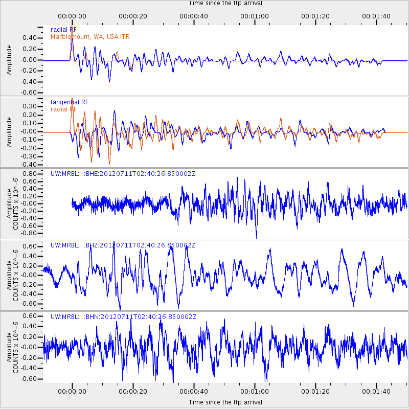
MRBL Marblemount, WA, USA - Earthquake Result Viewer
*The percent match for this event was below the threshold and hence no stack was calculated.
| Earthquake location: |
Kuril Islands |
| Earthquake latitude/longitude: |
45.4/151.4 |
| Earthquake time(UTC): |
2012/07/11 (193) 02:31:16 GMT |
| Earthquake Depth: |
10 km |
| Earthquake Magnitude: |
5.6 MB, 5.5 MS, 5.7 MW, 5.7 MW |
| Earthquake Catalog/Contributor: |
WHDF/NEIC |
|
| Network: |
UW Pacific Northwest Regional Seismic Network |
| Station: |
MRBL Marblemount, WA, USA |
| Lat/Lon: |
48.52 N/121.48 W |
| Elevation: |
75 m |
|
| Distance: |
56.4 deg |
| Az: |
52.894 deg |
| Baz: |
302.319 deg |
| Ray Param: |
$rayparam |
*The percent match for this event was below the threshold and hence was not used in the summary stack. |
|
| Radial Match: |
74.32265 % |
| Radial Bump: |
400 |
| Transverse Match: |
63.562435 % |
| Transverse Bump: |
400 |
| SOD ConfigId: |
466652 |
| Insert Time: |
2013-02-21 14:31:41.793 +0000 |
| GWidth: |
2.5 |
| Max Bumps: |
400 |
| Tol: |
0.001 |
|
Signal To Noise
| Channel | StoN | STA | LTA |
| UW:MRBL: :BHZ:20120711T02:40:26.850002Z | 2.5357842 | 2.2359995E-7 | 8.817783E-8 |
| UW:MRBL: :BHN:20120711T02:40:26.850002Z | 0.94627756 | 1.0477969E-7 | 1.1072829E-7 |
| UW:MRBL: :BHE:20120711T02:40:26.850002Z | 1.7935103 | 1.997425E-7 | 1.1136959E-7 |
| Arrivals |
| Ps | |
| PpPs | |
| PsPs/PpSs | |


