You are here: Home > Network List > CI - Caltech Regional Seismic Network Stations List
> Station MPM Manuel Prospect Mine, California, USA > Earthquake Result Viewer
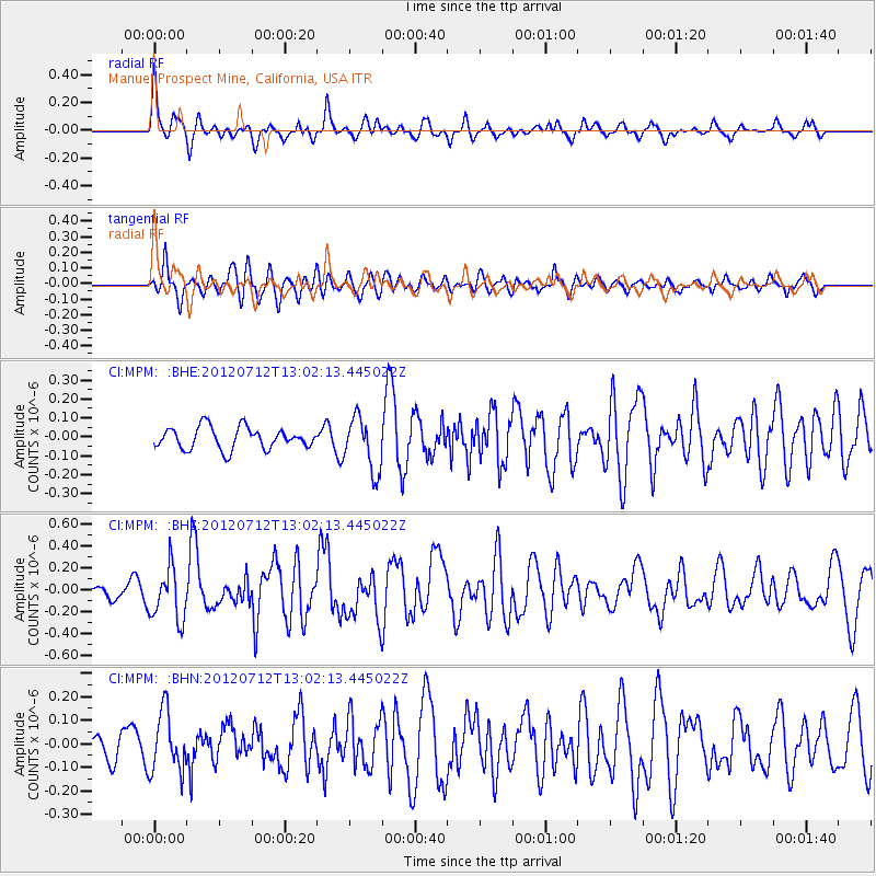
MPM Manuel Prospect Mine, California, USA - Earthquake Result Viewer
*The percent match for this event was below the threshold and hence no stack was calculated.
| Earthquake location: |
Kuril Islands |
| Earthquake latitude/longitude: |
45.5/151.7 |
| Earthquake time(UTC): |
2012/07/12 (194) 12:51:58 GMT |
| Earthquake Depth: |
12 km |
| Earthquake Magnitude: |
5.5 MB, 5.6 MS, 5.8 MW, 5.7 MW |
| Earthquake Catalog/Contributor: |
WHDF/NEIC |
|
| Network: |
CI Caltech Regional Seismic Network |
| Station: |
MPM Manuel Prospect Mine, California, USA |
| Lat/Lon: |
36.06 N/117.49 W |
| Elevation: |
185 m |
|
| Distance: |
65.9 deg |
| Az: |
62.543 deg |
| Baz: |
309.571 deg |
| Ray Param: |
$rayparam |
*The percent match for this event was below the threshold and hence was not used in the summary stack. |
|
| Radial Match: |
78.515755 % |
| Radial Bump: |
400 |
| Transverse Match: |
72.326065 % |
| Transverse Bump: |
400 |
| SOD ConfigId: |
466652 |
| Insert Time: |
2013-02-21 16:58:07.624 +0000 |
| GWidth: |
2.5 |
| Max Bumps: |
400 |
| Tol: |
0.001 |
|
Signal To Noise
| Channel | StoN | STA | LTA |
| CI:MPM: :BHZ:20120712T13:02:13.445022Z | 2.9966502 | 2.393861E-7 | 7.988457E-8 |
| CI:MPM: :BHN:20120712T13:02:13.445022Z | 2.0035899 | 1.2687183E-7 | 6.3322254E-8 |
| CI:MPM: :BHE:20120712T13:02:13.445022Z | 2.4996927 | 1.4214419E-7 | 5.6864668E-8 |
| Arrivals |
| Ps | |
| PpPs | |
| PsPs/PpSs | |


