You are here: Home > Network List > TA - USArray Transportable Network (new EarthScope stations) Stations List
> Station T40A Mansfield, MO, USA > Earthquake Result Viewer
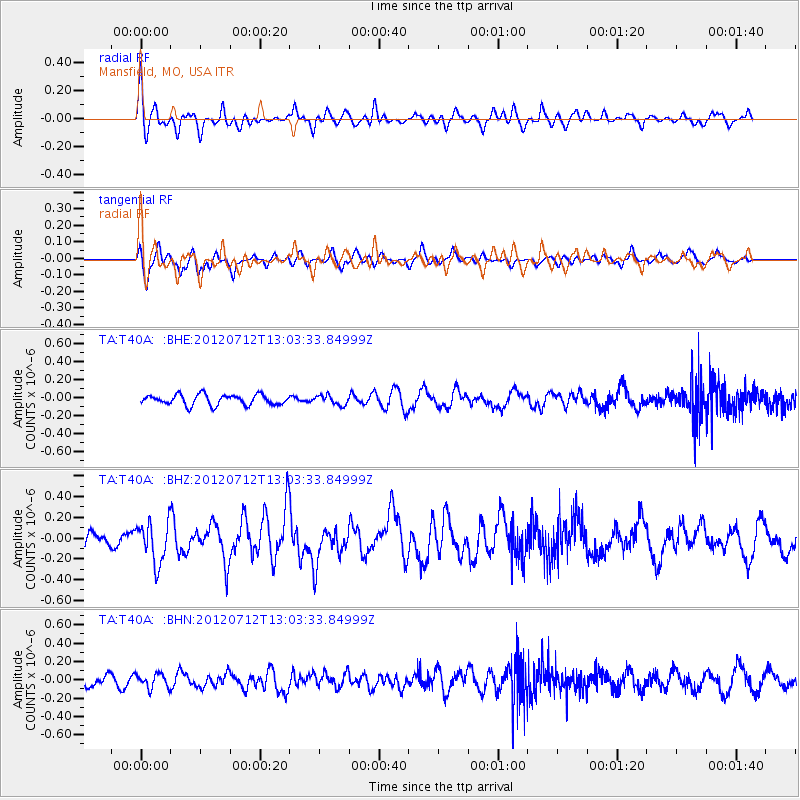
T40A Mansfield, MO, USA - Earthquake Result Viewer
*The percent match for this event was below the threshold and hence no stack was calculated.
| Earthquake location: |
Kuril Islands |
| Earthquake latitude/longitude: |
45.5/151.7 |
| Earthquake time(UTC): |
2012/07/12 (194) 12:51:58 GMT |
| Earthquake Depth: |
12 km |
| Earthquake Magnitude: |
5.5 MB, 5.6 MS, 5.8 MW, 5.7 MW |
| Earthquake Catalog/Contributor: |
WHDF/NEIC |
|
| Network: |
TA USArray Transportable Network (new EarthScope stations) |
| Station: |
T40A Mansfield, MO, USA |
| Lat/Lon: |
37.15 N/92.52 W |
| Elevation: |
399 m |
|
| Distance: |
79.5 deg |
| Az: |
47.013 deg |
| Baz: |
319.877 deg |
| Ray Param: |
$rayparam |
*The percent match for this event was below the threshold and hence was not used in the summary stack. |
|
| Radial Match: |
61.90013 % |
| Radial Bump: |
400 |
| Transverse Match: |
64.03812 % |
| Transverse Bump: |
400 |
| SOD ConfigId: |
467763 |
| Insert Time: |
2013-02-21 17:22:00.135 +0000 |
| GWidth: |
2.5 |
| Max Bumps: |
400 |
| Tol: |
0.001 |
|
Signal To Noise
| Channel | StoN | STA | LTA |
| TA:T40A: :BHZ:20120712T13:03:33.84999Z | 2.123746 | 1.9806832E-7 | 9.326366E-8 |
| TA:T40A: :BHN:20120712T13:03:33.84999Z | 1.0423975 | 7.75302E-8 | 7.437681E-8 |
| TA:T40A: :BHE:20120712T13:03:33.84999Z | 0.9261171 | 5.318087E-8 | 5.742348E-8 |
| Arrivals |
| Ps | |
| PpPs | |
| PsPs/PpSs | |


