You are here: Home > Network List > TA - USArray Transportable Network (new EarthScope stations) Stations List
> Station 249A Camden, AL, USA > Earthquake Result Viewer
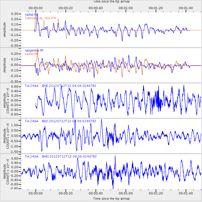
249A Camden, AL, USA - Earthquake Result Viewer
*The percent match for this event was below the threshold and hence no stack was calculated.
| Earthquake location: |
Kuril Islands |
| Earthquake latitude/longitude: |
45.5/151.7 |
| Earthquake time(UTC): |
2012/07/12 (194) 12:51:58 GMT |
| Earthquake Depth: |
12 km |
| Earthquake Magnitude: |
5.5 MB, 5.6 MS, 5.8 MW, 5.7 MW |
| Earthquake Catalog/Contributor: |
WHDF/NEIC |
|
| Network: |
TA USArray Transportable Network (new EarthScope stations) |
| Station: |
249A Camden, AL, USA |
| Lat/Lon: |
31.98 N/87.12 W |
| Elevation: |
66 m |
|
| Distance: |
86.3 deg |
| Az: |
46.749 deg |
| Baz: |
322.896 deg |
| Ray Param: |
$rayparam |
*The percent match for this event was below the threshold and hence was not used in the summary stack. |
|
| Radial Match: |
57.40949 % |
| Radial Bump: |
400 |
| Transverse Match: |
54.522774 % |
| Transverse Bump: |
400 |
| SOD ConfigId: |
467763 |
| Insert Time: |
2013-02-21 17:33:04.765 +0000 |
| GWidth: |
2.5 |
| Max Bumps: |
400 |
| Tol: |
0.001 |
|
Signal To Noise
| Channel | StoN | STA | LTA |
| TA:249A: :BHZ:20120712T13:04:09.024978Z | 3.696851 | 4.9315594E-7 | 1.3339893E-7 |
| TA:249A: :BHN:20120712T13:04:09.024978Z | 0.78205854 | 1.4617932E-7 | 1.8691608E-7 |
| TA:249A: :BHE:20120712T13:04:09.024978Z | 0.6921898 | 2.1252292E-7 | 3.0702984E-7 |
| Arrivals |
| Ps | |
| PpPs | |
| PsPs/PpSs | |


