You are here: Home > Network List > UW - Pacific Northwest Regional Seismic Network Stations List
> Station MRBL Marblemount, WA, USA > Earthquake Result Viewer
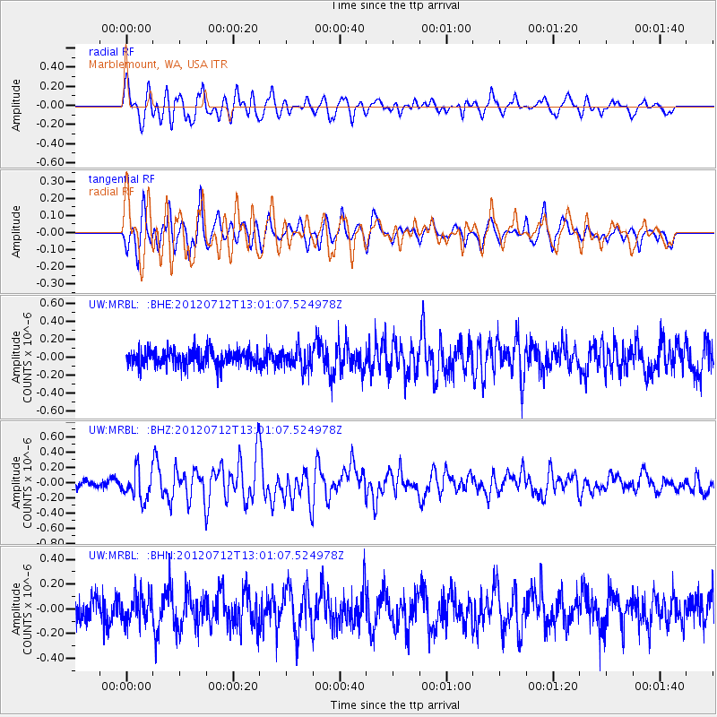
MRBL Marblemount, WA, USA - Earthquake Result Viewer
*The percent match for this event was below the threshold and hence no stack was calculated.
| Earthquake location: |
Kuril Islands |
| Earthquake latitude/longitude: |
45.5/151.7 |
| Earthquake time(UTC): |
2012/07/12 (194) 12:51:58 GMT |
| Earthquake Depth: |
12 km |
| Earthquake Magnitude: |
5.5 MB, 5.6 MS, 5.8 MW, 5.7 MW |
| Earthquake Catalog/Contributor: |
WHDF/NEIC |
|
| Network: |
UW Pacific Northwest Regional Seismic Network |
| Station: |
MRBL Marblemount, WA, USA |
| Lat/Lon: |
48.52 N/121.48 W |
| Elevation: |
75 m |
|
| Distance: |
56.2 deg |
| Az: |
53.024 deg |
| Baz: |
302.245 deg |
| Ray Param: |
$rayparam |
*The percent match for this event was below the threshold and hence was not used in the summary stack. |
|
| Radial Match: |
75.20432 % |
| Radial Bump: |
400 |
| Transverse Match: |
75.38809 % |
| Transverse Bump: |
400 |
| SOD ConfigId: |
467763 |
| Insert Time: |
2013-02-21 17:39:06.159 +0000 |
| GWidth: |
2.5 |
| Max Bumps: |
400 |
| Tol: |
0.001 |
|
Signal To Noise
| Channel | StoN | STA | LTA |
| UW:MRBL: :BHZ:20120712T13:01:07.524978Z | 2.9452705 | 1.9406501E-7 | 6.589038E-8 |
| UW:MRBL: :BHN:20120712T13:01:07.524978Z | 1.1084318 | 1.100121E-7 | 9.9250215E-8 |
| UW:MRBL: :BHE:20120712T13:01:07.524978Z | 1.3190401 | 1.1763435E-7 | 8.918179E-8 |
| Arrivals |
| Ps | |
| PpPs | |
| PsPs/PpSs | |


