You are here: Home > Network List > AK - Alaska Regional Network Stations List
> Station MDM Murphy Dome > Earthquake Result Viewer
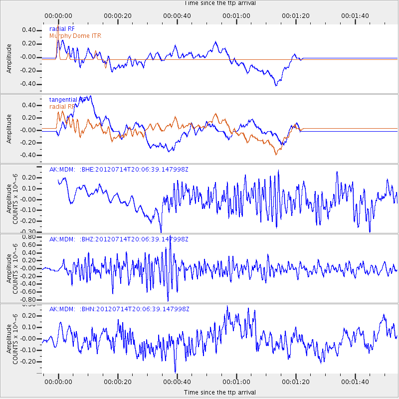
MDM Murphy Dome - Earthquake Result Viewer
*The percent match for this event was below the threshold and hence no stack was calculated.
| Earthquake location: |
Myanmar-India Border Region |
| Earthquake latitude/longitude: |
25.4/94.5 |
| Earthquake time(UTC): |
2012/07/14 (196) 19:55:17 GMT |
| Earthquake Depth: |
52 km |
| Earthquake Magnitude: |
5.5 MB, 5.2 MW, 5.3 MW |
| Earthquake Catalog/Contributor: |
WHDF/NEIC |
|
| Network: |
AK Alaska Regional Network |
| Station: |
MDM Murphy Dome |
| Lat/Lon: |
64.96 N/148.23 W |
| Elevation: |
634 m |
|
| Distance: |
77.9 deg |
| Az: |
22.759 deg |
| Baz: |
304.722 deg |
| Ray Param: |
$rayparam |
*The percent match for this event was below the threshold and hence was not used in the summary stack. |
|
| Radial Match: |
29.930052 % |
| Radial Bump: |
400 |
| Transverse Match: |
37.717133 % |
| Transverse Bump: |
400 |
| SOD ConfigId: |
467763 |
| Insert Time: |
2013-02-21 18:00:11.413 +0000 |
| GWidth: |
2.5 |
| Max Bumps: |
400 |
| Tol: |
0.001 |
|
Signal To Noise
| Channel | StoN | STA | LTA |
| AK:MDM: :BHZ:20120714T20:06:39.147998Z | 3.2819657 | 1.2581718E-7 | 3.8335923E-8 |
| AK:MDM: :BHN:20120714T20:06:39.147998Z | 0.6732992 | 6.4082236E-8 | 9.517647E-8 |
| AK:MDM: :BHE:20120714T20:06:39.147998Z | 3.4885123 | 2.2912833E-7 | 6.5680815E-8 |
| Arrivals |
| Ps | |
| PpPs | |
| PsPs/PpSs | |


