You are here: Home > Network List > IW - Intermountain West Stations List
> Station MOOW Moose Ponds, Wyoming, USA > Earthquake Result Viewer
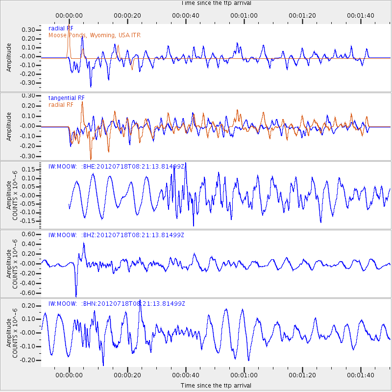
MOOW Moose Ponds, Wyoming, USA - Earthquake Result Viewer
*The percent match for this event was below the threshold and hence no stack was calculated.
| Earthquake location: |
Fiji Islands Region |
| Earthquake latitude/longitude: |
-20.9/-178.5 |
| Earthquake time(UTC): |
2012/07/18 (200) 08:09:46 GMT |
| Earthquake Depth: |
537 km |
| Earthquake Magnitude: |
5.5 MB, 5.9 MW, 6.0 MW |
| Earthquake Catalog/Contributor: |
WHDF/NEIC |
|
| Network: |
IW Intermountain West |
| Station: |
MOOW Moose Ponds, Wyoming, USA |
| Lat/Lon: |
43.75 N/110.74 W |
| Elevation: |
2128 m |
|
| Distance: |
89.3 deg |
| Az: |
42.133 deg |
| Baz: |
239.961 deg |
| Ray Param: |
$rayparam |
*The percent match for this event was below the threshold and hence was not used in the summary stack. |
|
| Radial Match: |
75.89481 % |
| Radial Bump: |
341 |
| Transverse Match: |
22.724005 % |
| Transverse Bump: |
400 |
| SOD ConfigId: |
467763 |
| Insert Time: |
2013-02-21 18:25:23.257 +0000 |
| GWidth: |
2.5 |
| Max Bumps: |
400 |
| Tol: |
0.001 |
|
Signal To Noise
| Channel | StoN | STA | LTA |
| IW:MOOW: :BHZ:20120718T08:21:13.81499Z | 2.9566581 | 2.1219799E-7 | 7.176954E-8 |
| IW:MOOW: :BHN:20120718T08:21:13.81499Z | 1.4108473 | 9.4201496E-8 | 6.6769445E-8 |
| IW:MOOW: :BHE:20120718T08:21:13.81499Z | 0.6642633 | 4.8143292E-8 | 7.247622E-8 |
| Arrivals |
| Ps | |
| PpPs | |
| PsPs/PpSs | |


