You are here: Home > Network List > TA - USArray Transportable Network (new EarthScope stations) Stations List
> Station T25A Trinidad, CO, USA > Earthquake Result Viewer
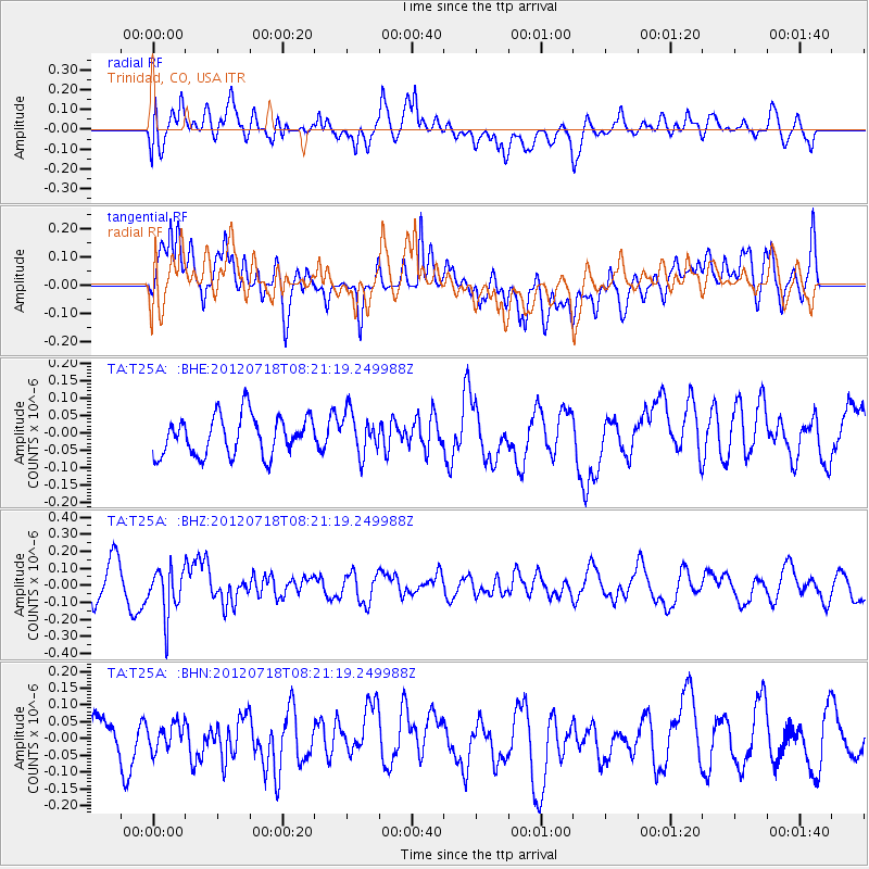
T25A Trinidad, CO, USA - Earthquake Result Viewer
*The percent match for this event was below the threshold and hence no stack was calculated.
| Earthquake location: |
Fiji Islands Region |
| Earthquake latitude/longitude: |
-20.9/-178.5 |
| Earthquake time(UTC): |
2012/07/18 (200) 08:09:46 GMT |
| Earthquake Depth: |
537 km |
| Earthquake Magnitude: |
5.5 MB, 5.9 MW, 6.0 MW |
| Earthquake Catalog/Contributor: |
WHDF/NEIC |
|
| Network: |
TA USArray Transportable Network (new EarthScope stations) |
| Station: |
T25A Trinidad, CO, USA |
| Lat/Lon: |
37.14 N/104.41 W |
| Elevation: |
2017 m |
|
| Distance: |
90.5 deg |
| Az: |
50.225 deg |
| Baz: |
244.081 deg |
| Ray Param: |
$rayparam |
*The percent match for this event was below the threshold and hence was not used in the summary stack. |
|
| Radial Match: |
43.578514 % |
| Radial Bump: |
400 |
| Transverse Match: |
61.567604 % |
| Transverse Bump: |
400 |
| SOD ConfigId: |
467763 |
| Insert Time: |
2013-02-21 18:29:56.892 +0000 |
| GWidth: |
2.5 |
| Max Bumps: |
400 |
| Tol: |
0.001 |
|
Signal To Noise
| Channel | StoN | STA | LTA |
| TA:T25A: :BHZ:20120718T08:21:19.249988Z | 1.5305654 | 1.4151983E-7 | 9.246246E-8 |
| TA:T25A: :BHN:20120718T08:21:19.249988Z | 0.76000345 | 3.803714E-8 | 5.004864E-8 |
| TA:T25A: :BHE:20120718T08:21:19.249988Z | 1.0538937 | 5.927593E-8 | 5.6244694E-8 |
| Arrivals |
| Ps | |
| PpPs | |
| PsPs/PpSs | |


