You are here: Home > Network List > UW - Pacific Northwest Regional Seismic Network Stations List
> Station MRBL Marblemount, WA, USA > Earthquake Result Viewer
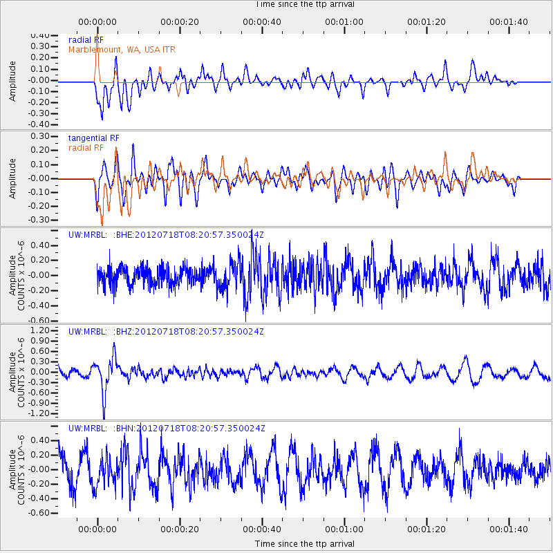
MRBL Marblemount, WA, USA - Earthquake Result Viewer
*The percent match for this event was below the threshold and hence no stack was calculated.
| Earthquake location: |
Fiji Islands Region |
| Earthquake latitude/longitude: |
-20.9/-178.5 |
| Earthquake time(UTC): |
2012/07/18 (200) 08:09:46 GMT |
| Earthquake Depth: |
537 km |
| Earthquake Magnitude: |
5.5 MB, 5.9 MW, 6.0 MW |
| Earthquake Catalog/Contributor: |
WHDF/NEIC |
|
| Network: |
UW Pacific Northwest Regional Seismic Network |
| Station: |
MRBL Marblemount, WA, USA |
| Lat/Lon: |
48.52 N/121.48 W |
| Elevation: |
75 m |
|
| Distance: |
85.8 deg |
| Az: |
34.007 deg |
| Baz: |
231.874 deg |
| Ray Param: |
$rayparam |
*The percent match for this event was below the threshold and hence was not used in the summary stack. |
|
| Radial Match: |
48.03716 % |
| Radial Bump: |
400 |
| Transverse Match: |
53.416523 % |
| Transverse Bump: |
400 |
| SOD ConfigId: |
468427 |
| Insert Time: |
2013-02-21 21:52:31.586 +0000 |
| GWidth: |
2.5 |
| Max Bumps: |
400 |
| Tol: |
0.001 |
|
Signal To Noise
| Channel | StoN | STA | LTA |
| UW:MRBL: :BHZ:20120718T08:20:57.350024Z | 3.5773094 | 5.196835E-7 | 1.4527218E-7 |
| UW:MRBL: :BHN:20120718T08:20:57.350024Z | 1.0015895 | 1.8711273E-7 | 1.8681578E-7 |
| UW:MRBL: :BHE:20120718T08:20:57.350024Z | 1.6327711 | 1.8104443E-7 | 1.1088169E-7 |
| Arrivals |
| Ps | |
| PpPs | |
| PsPs/PpSs | |


