You are here: Home > Network List > TA - USArray Transportable Network (new EarthScope stations) Stations List
> Station MDND Maddock, ND, USA > Earthquake Result Viewer
MDND Maddock, ND, USA - Earthquake Result Viewer
*The percent match for this event was below the threshold and hence no stack was calculated.
| Earthquake location: |
Afghanistan-Tajikistan Bord Reg. |
| Earthquake latitude/longitude: |
37.2/71.4 |
| Earthquake time(UTC): |
2012/07/19 (201) 07:36:35 GMT |
| Earthquake Depth: |
98 km |
| Earthquake Magnitude: |
5.5 MB, 5.6 MW, 5.6 MW |
| Earthquake Catalog/Contributor: |
WHDF/NEIC |
|
| Network: |
TA USArray Transportable Network (new EarthScope stations) |
| Station: |
MDND Maddock, ND, USA |
| Lat/Lon: |
47.85 N/99.60 W |
| Elevation: |
479 m |
|
| Distance: |
94.9 deg |
| Az: |
353.914 deg |
| Baz: |
7.215 deg |
| Ray Param: |
$rayparam |
*The percent match for this event was below the threshold and hence was not used in the summary stack. |
|
| Radial Match: |
65.30671 % |
| Radial Bump: |
400 |
| Transverse Match: |
68.94327 % |
| Transverse Bump: |
400 |
| SOD ConfigId: |
468427 |
| Insert Time: |
2013-02-21 22:00:15.403 +0000 |
| GWidth: |
2.5 |
| Max Bumps: |
400 |
| Tol: |
0.001 |
|
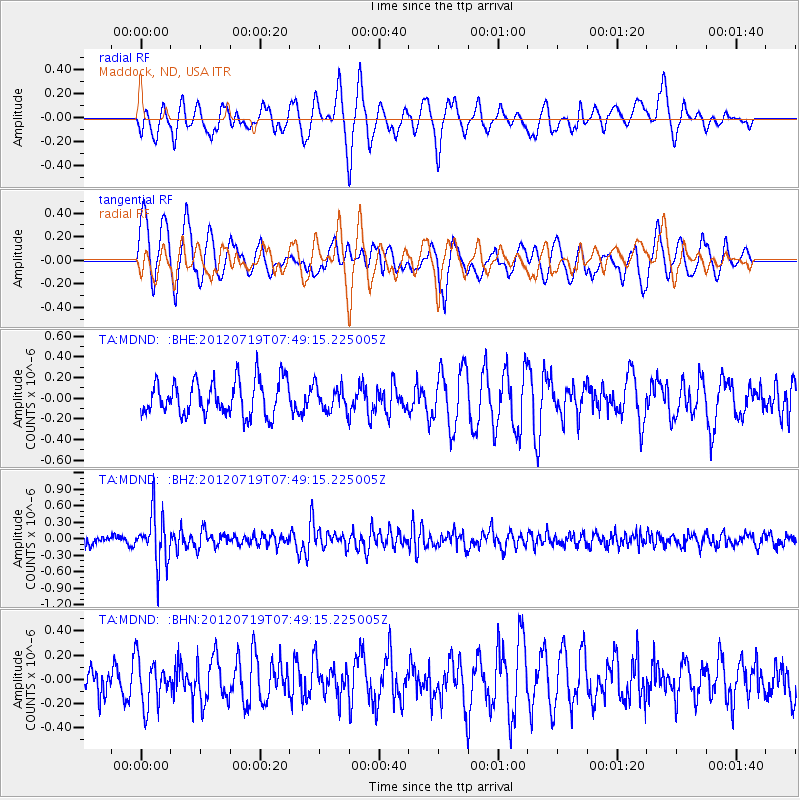
Signal To Noise
| Channel | StoN | STA | LTA |
| TA:MDND: :BHZ:20120719T07:49:15.225005Z | 5.2506695 | 4.5514344E-7 | 8.668294E-8 |
| TA:MDND: :BHN:20120719T07:49:15.225005Z | 1.6034569 | 1.8948442E-7 | 1.1817245E-7 |
| TA:MDND: :BHE:20120719T07:49:15.225005Z | 0.71261734 | 1.1920407E-7 | 1.6727641E-7 |
| Arrivals |
| Ps | |
| PpPs | |
| PsPs/PpSs | |


