You are here: Home > Network List > TA - USArray Transportable Network (new EarthScope stations) Stations List
> Station D37A Cotton, MN, USA > Earthquake Result Viewer
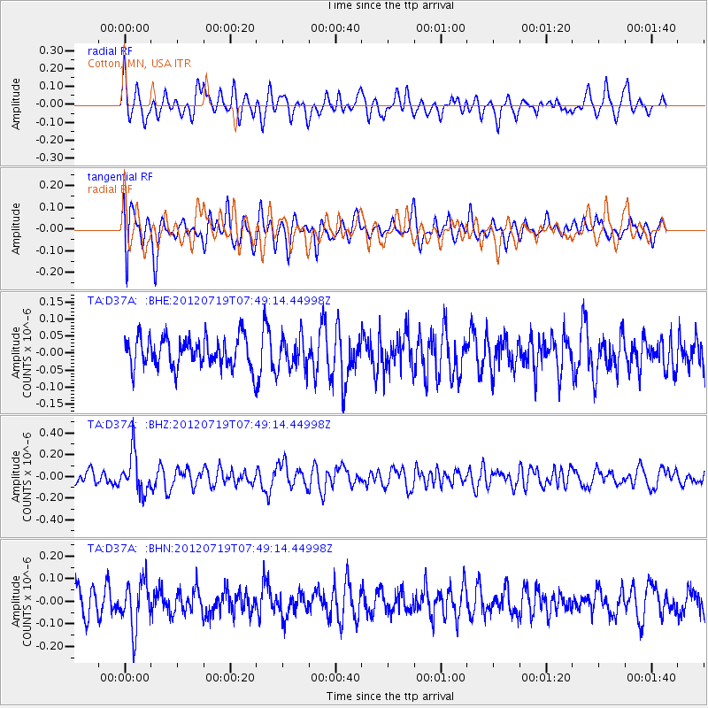
D37A Cotton, MN, USA - Earthquake Result Viewer
*The percent match for this event was below the threshold and hence no stack was calculated.
| Earthquake location: |
Afghanistan-Tajikistan Bord Reg. |
| Earthquake latitude/longitude: |
37.2/71.4 |
| Earthquake time(UTC): |
2012/07/19 (201) 07:36:35 GMT |
| Earthquake Depth: |
98 km |
| Earthquake Magnitude: |
5.5 MB, 5.6 MW, 5.6 MW |
| Earthquake Catalog/Contributor: |
WHDF/NEIC |
|
| Network: |
TA USArray Transportable Network (new EarthScope stations) |
| Station: |
D37A Cotton, MN, USA |
| Lat/Lon: |
47.16 N/92.43 W |
| Elevation: |
413 m |
|
| Distance: |
94.7 deg |
| Az: |
348.987 deg |
| Baz: |
12.907 deg |
| Ray Param: |
$rayparam |
*The percent match for this event was below the threshold and hence was not used in the summary stack. |
|
| Radial Match: |
55.504395 % |
| Radial Bump: |
400 |
| Transverse Match: |
48.721054 % |
| Transverse Bump: |
400 |
| SOD ConfigId: |
468427 |
| Insert Time: |
2013-02-21 22:01:15.435 +0000 |
| GWidth: |
2.5 |
| Max Bumps: |
400 |
| Tol: |
0.001 |
|
Signal To Noise
| Channel | StoN | STA | LTA |
| TA:D37A: :BHZ:20120719T07:49:14.44998Z | 3.6590855 | 1.8464901E-7 | 5.0463157E-8 |
| TA:D37A: :BHN:20120719T07:49:14.44998Z | 2.142626 | 1.0745216E-7 | 5.014975E-8 |
| TA:D37A: :BHE:20120719T07:49:14.44998Z | 1.0560082 | 4.629243E-8 | 4.383719E-8 |
| Arrivals |
| Ps | |
| PpPs | |
| PsPs/PpSs | |


