You are here: Home > Network List > TA - USArray Transportable Network (new EarthScope stations) Stations List
> Station H41A Junction City, WI, USA > Earthquake Result Viewer
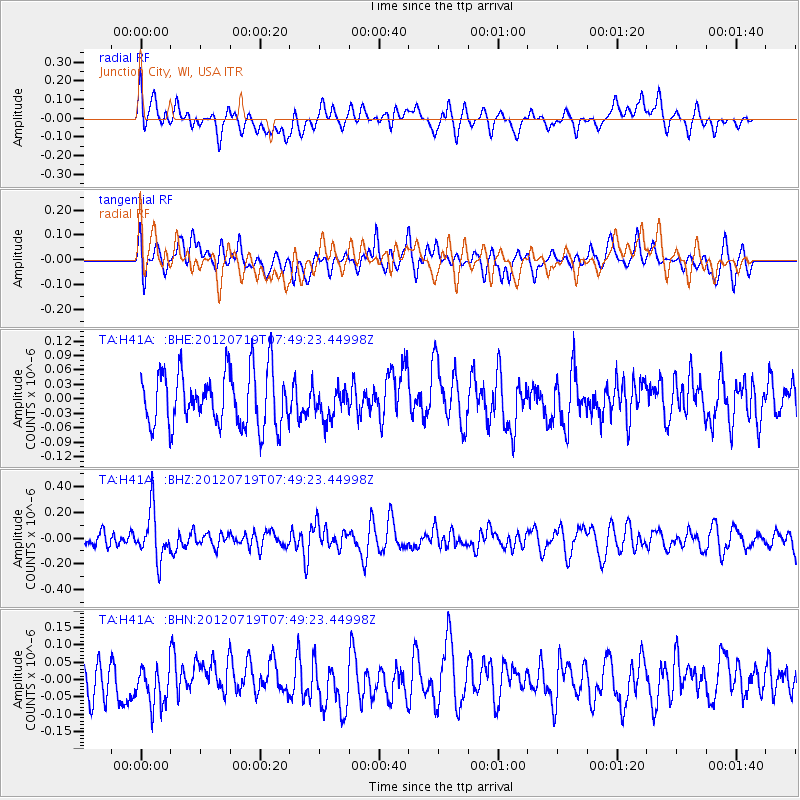
H41A Junction City, WI, USA - Earthquake Result Viewer
*The percent match for this event was below the threshold and hence no stack was calculated.
| Earthquake location: |
Afghanistan-Tajikistan Bord Reg. |
| Earthquake latitude/longitude: |
37.2/71.4 |
| Earthquake time(UTC): |
2012/07/19 (201) 07:36:35 GMT |
| Earthquake Depth: |
98 km |
| Earthquake Magnitude: |
5.5 MB, 5.6 MW, 5.6 MW |
| Earthquake Catalog/Contributor: |
WHDF/NEIC |
|
| Network: |
TA USArray Transportable Network (new EarthScope stations) |
| Station: |
H41A Junction City, WI, USA |
| Lat/Lon: |
44.62 N/89.65 W |
| Elevation: |
348 m |
|
| Distance: |
96.7 deg |
| Az: |
346.48 deg |
| Baz: |
15.142 deg |
| Ray Param: |
$rayparam |
*The percent match for this event was below the threshold and hence was not used in the summary stack. |
|
| Radial Match: |
46.001564 % |
| Radial Bump: |
400 |
| Transverse Match: |
57.468395 % |
| Transverse Bump: |
400 |
| SOD ConfigId: |
468427 |
| Insert Time: |
2013-02-21 22:03:56.948 +0000 |
| GWidth: |
2.5 |
| Max Bumps: |
400 |
| Tol: |
0.001 |
|
Signal To Noise
| Channel | StoN | STA | LTA |
| TA:H41A: :BHZ:20120719T07:49:23.44998Z | 2.522143 | 1.8754542E-7 | 7.435955E-8 |
| TA:H41A: :BHN:20120719T07:49:23.44998Z | 1.0374491 | 5.6384447E-8 | 5.434912E-8 |
| TA:H41A: :BHE:20120719T07:49:23.44998Z | 0.5445787 | 3.07079E-8 | 5.6388362E-8 |
| Arrivals |
| Ps | |
| PpPs | |
| PsPs/PpSs | |


