You are here: Home > Network List > TA - USArray Transportable Network (new EarthScope stations) Stations List
> Station H38A Maiden Rock, WI, USA > Earthquake Result Viewer
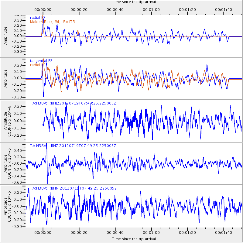
H38A Maiden Rock, WI, USA - Earthquake Result Viewer
*The percent match for this event was below the threshold and hence no stack was calculated.
| Earthquake location: |
Afghanistan-Tajikistan Bord Reg. |
| Earthquake latitude/longitude: |
37.2/71.4 |
| Earthquake time(UTC): |
2012/07/19 (201) 07:36:35 GMT |
| Earthquake Depth: |
98 km |
| Earthquake Magnitude: |
5.5 MB, 5.6 MW, 5.6 MW |
| Earthquake Catalog/Contributor: |
WHDF/NEIC |
|
| Network: |
TA USArray Transportable Network (new EarthScope stations) |
| Station: |
H38A Maiden Rock, WI, USA |
| Lat/Lon: |
44.68 N/92.28 W |
| Elevation: |
333 m |
|
| Distance: |
97.1 deg |
| Az: |
348.327 deg |
| Baz: |
13.079 deg |
| Ray Param: |
$rayparam |
*The percent match for this event was below the threshold and hence was not used in the summary stack. |
|
| Radial Match: |
55.32217 % |
| Radial Bump: |
400 |
| Transverse Match: |
58.613323 % |
| Transverse Bump: |
400 |
| SOD ConfigId: |
468427 |
| Insert Time: |
2013-02-21 22:04:08.402 +0000 |
| GWidth: |
2.5 |
| Max Bumps: |
400 |
| Tol: |
0.001 |
|
Signal To Noise
| Channel | StoN | STA | LTA |
| TA:H38A: :BHZ:20120719T07:49:25.225005Z | 3.617177 | 2.6304454E-7 | 7.2720944E-8 |
| TA:H38A: :BHN:20120719T07:49:25.225005Z | 1.3588605 | 1.2234646E-7 | 9.0036075E-8 |
| TA:H38A: :BHE:20120719T07:49:25.225005Z | 0.94277 | 8.382565E-8 | 8.891421E-8 |
| Arrivals |
| Ps | |
| PpPs | |
| PsPs/PpSs | |


