You are here: Home > Network List > TA - USArray Transportable Network (new EarthScope stations) Stations List
> Station G43A Wallace, MI, USA > Earthquake Result Viewer
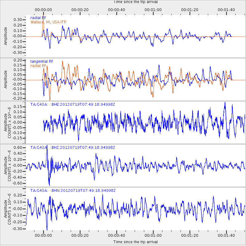
G43A Wallace, MI, USA - Earthquake Result Viewer
*The percent match for this event was below the threshold and hence no stack was calculated.
| Earthquake location: |
Afghanistan-Tajikistan Bord Reg. |
| Earthquake latitude/longitude: |
37.2/71.4 |
| Earthquake time(UTC): |
2012/07/19 (201) 07:36:35 GMT |
| Earthquake Depth: |
98 km |
| Earthquake Magnitude: |
5.5 MB, 5.6 MW, 5.6 MW |
| Earthquake Catalog/Contributor: |
WHDF/NEIC |
|
| Network: |
TA USArray Transportable Network (new EarthScope stations) |
| Station: |
G43A Wallace, MI, USA |
| Lat/Lon: |
45.26 N/87.69 W |
| Elevation: |
213 m |
|
| Distance: |
95.7 deg |
| Az: |
345.305 deg |
| Baz: |
16.655 deg |
| Ray Param: |
$rayparam |
*The percent match for this event was below the threshold and hence was not used in the summary stack. |
|
| Radial Match: |
56.518337 % |
| Radial Bump: |
400 |
| Transverse Match: |
62.82068 % |
| Transverse Bump: |
400 |
| SOD ConfigId: |
468427 |
| Insert Time: |
2013-02-21 22:05:44.384 +0000 |
| GWidth: |
2.5 |
| Max Bumps: |
400 |
| Tol: |
0.001 |
|
Signal To Noise
| Channel | StoN | STA | LTA |
| TA:G43A: :BHZ:20120719T07:49:18.94998Z | 2.9745405 | 2.9218637E-7 | 9.822907E-8 |
| TA:G43A: :BHN:20120719T07:49:18.94998Z | 1.8383969 | 1.1800363E-7 | 6.4188335E-8 |
| TA:G43A: :BHE:20120719T07:49:18.94998Z | 0.8425465 | 4.178095E-8 | 4.958889E-8 |
| Arrivals |
| Ps | |
| PpPs | |
| PsPs/PpSs | |


