You are here: Home > Network List > G - GEOSCOPE Stations List
> Station SSB Saint Sauveur Badole, France > Earthquake Result Viewer
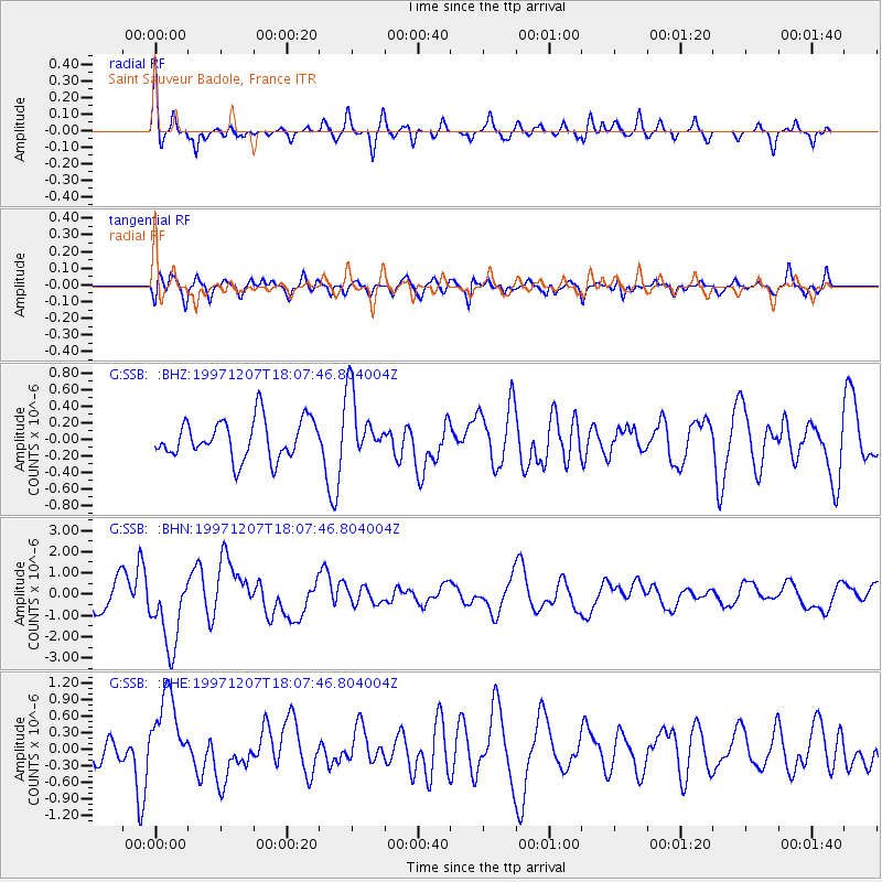
SSB Saint Sauveur Badole, France - Earthquake Result Viewer
*The percent match for this event was below the threshold and hence no stack was calculated.
| Earthquake location: |
Near East Coast Of Kamchatka |
| Earthquake latitude/longitude: |
54.7/162.9 |
| Earthquake time(UTC): |
1997/12/07 (341) 17:56:18 GMT |
| Earthquake Depth: |
33 km |
| Earthquake Magnitude: |
5.6 MB, 6.0 MS, 6.3 UNKNOWN, 6.1 MW |
| Earthquake Catalog/Contributor: |
WHDF/NEIC |
|
| Network: |
G GEOSCOPE |
| Station: |
SSB Saint Sauveur Badole, France |
| Lat/Lon: |
45.28 N/4.54 E |
| Elevation: |
700 m |
|
| Distance: |
78.7 deg |
| Az: |
344.591 deg |
| Baz: |
12.631 deg |
| Ray Param: |
$rayparam |
*The percent match for this event was below the threshold and hence was not used in the summary stack. |
|
| Radial Match: |
72.56549 % |
| Radial Bump: |
301 |
| Transverse Match: |
66.1174 % |
| Transverse Bump: |
400 |
| SOD ConfigId: |
4480 |
| Insert Time: |
2010-02-27 00:20:51.821 +0000 |
| GWidth: |
2.5 |
| Max Bumps: |
400 |
| Tol: |
0.001 |
|
Signal To Noise
| Channel | StoN | STA | LTA |
| G:SSB: :BHN:19971207T18:07:46.804004Z | 2.88159 | 1.7784164E-6 | 6.1716497E-7 |
| G:SSB: :BHE:19971207T18:07:46.804004Z | 3.4558103 | 7.063529E-7 | 2.0439575E-7 |
| G:SSB: :BHZ:19971207T18:07:46.804004Z | 1.6922071 | 3.9681206E-7 | 2.3449378E-7 |
| Arrivals |
| Ps | |
| PpPs | |
| PsPs/PpSs | |


