You are here: Home > Network List > AK - Alaska Regional Network Stations List
> Station MDM Murphy Dome > Earthquake Result Viewer
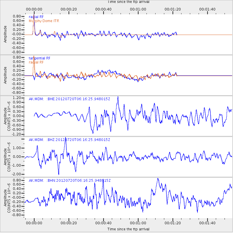
MDM Murphy Dome - Earthquake Result Viewer
*The percent match for this event was below the threshold and hence no stack was calculated.
| Earthquake location: |
Kuril Islands |
| Earthquake latitude/longitude: |
49.4/155.9 |
| Earthquake time(UTC): |
2012/07/20 (202) 06:10:25 GMT |
| Earthquake Depth: |
19 km |
| Earthquake Magnitude: |
5.7 MB, 5.7 MS, 6.0 MW, 6.1 MW |
| Earthquake Catalog/Contributor: |
WHDF/NEIC |
|
| Network: |
AK Alaska Regional Network |
| Station: |
MDM Murphy Dome |
| Lat/Lon: |
64.96 N/148.23 W |
| Elevation: |
634 m |
|
| Distance: |
32.7 deg |
| Az: |
40.653 deg |
| Baz: |
269.001 deg |
| Ray Param: |
$rayparam |
*The percent match for this event was below the threshold and hence was not used in the summary stack. |
|
| Radial Match: |
61.573586 % |
| Radial Bump: |
400 |
| Transverse Match: |
47.9318 % |
| Transverse Bump: |
400 |
| SOD ConfigId: |
468427 |
| Insert Time: |
2013-02-21 22:09:43.101 +0000 |
| GWidth: |
2.5 |
| Max Bumps: |
400 |
| Tol: |
0.001 |
|
Signal To Noise
| Channel | StoN | STA | LTA |
| AK:MDM: :BHZ:20120720T06:16:25.948015Z | 9.616861 | 6.731729E-7 | 6.999923E-8 |
| AK:MDM: :BHN:20120720T06:16:25.948015Z | 1.6999063 | 1.7015006E-7 | 1.0009379E-7 |
| AK:MDM: :BHE:20120720T06:16:25.948015Z | 6.6802034 | 6.5852873E-7 | 9.857914E-8 |
| Arrivals |
| Ps | |
| PpPs | |
| PsPs/PpSs | |


