You are here: Home > Network List > BK - Berkeley Digital Seismograph Network Stations List
> Station HUMO Hull Mountain, OR > Earthquake Result Viewer
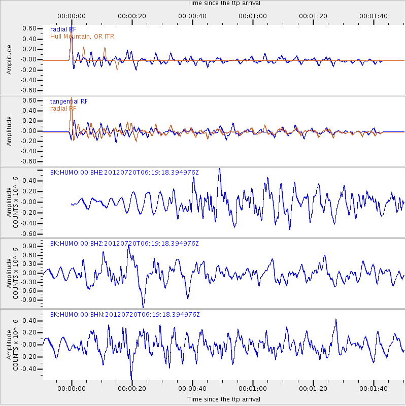
HUMO Hull Mountain, OR - Earthquake Result Viewer
*The percent match for this event was below the threshold and hence no stack was calculated.
| Earthquake location: |
Kuril Islands |
| Earthquake latitude/longitude: |
49.4/155.9 |
| Earthquake time(UTC): |
2012/07/20 (202) 06:10:25 GMT |
| Earthquake Depth: |
19 km |
| Earthquake Magnitude: |
5.7 MB, 5.7 MS, 6.0 MW, 6.1 MW |
| Earthquake Catalog/Contributor: |
WHDF/NEIC |
|
| Network: |
BK Berkeley Digital Seismograph Network |
| Station: |
HUMO Hull Mountain, OR |
| Lat/Lon: |
42.61 N/122.96 W |
| Elevation: |
555 m |
|
| Distance: |
54.2 deg |
| Az: |
64.085 deg |
| Baz: |
307.27 deg |
| Ray Param: |
$rayparam |
*The percent match for this event was below the threshold and hence was not used in the summary stack. |
|
| Radial Match: |
69.64774 % |
| Radial Bump: |
400 |
| Transverse Match: |
68.47147 % |
| Transverse Bump: |
400 |
| SOD ConfigId: |
468427 |
| Insert Time: |
2013-02-21 22:11:06.419 +0000 |
| GWidth: |
2.5 |
| Max Bumps: |
400 |
| Tol: |
0.001 |
|
Signal To Noise
| Channel | StoN | STA | LTA |
| BK:HUMO:00:BHZ:20120720T06:19:18.394976Z | 1.6832613 | 1.8360497E-7 | 1.0907692E-7 |
| BK:HUMO:00:BHN:20120720T06:19:18.394976Z | 0.8735822 | 6.275679E-8 | 7.183845E-8 |
| BK:HUMO:00:BHE:20120720T06:19:18.394976Z | 1.4582368 | 1.3180278E-7 | 9.038502E-8 |
| Arrivals |
| Ps | |
| PpPs | |
| PsPs/PpSs | |


