You are here: Home > Network List > CI - Caltech Regional Seismic Network Stations List
> Station GLA Glamis, Glamis, CA, USA > Earthquake Result Viewer
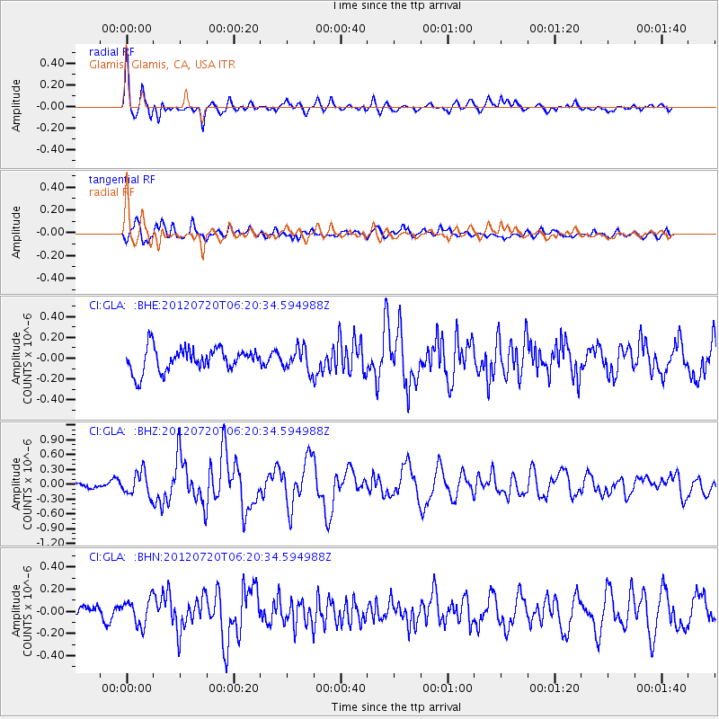
GLA Glamis, Glamis, CA, USA - Earthquake Result Viewer
*The percent match for this event was below the threshold and hence no stack was calculated.
| Earthquake location: |
Kuril Islands |
| Earthquake latitude/longitude: |
49.4/155.9 |
| Earthquake time(UTC): |
2012/07/20 (202) 06:10:25 GMT |
| Earthquake Depth: |
19 km |
| Earthquake Magnitude: |
5.7 MB, 5.7 MS, 6.0 MW, 6.1 MW |
| Earthquake Catalog/Contributor: |
WHDF/NEIC |
|
| Network: |
CI Caltech Regional Seismic Network |
| Station: |
GLA Glamis, Glamis, CA, USA |
| Lat/Lon: |
33.05 N/114.83 W |
| Elevation: |
610 m |
|
| Distance: |
65.3 deg |
| Az: |
67.583 deg |
| Baz: |
314.029 deg |
| Ray Param: |
$rayparam |
*The percent match for this event was below the threshold and hence was not used in the summary stack. |
|
| Radial Match: |
72.60357 % |
| Radial Bump: |
400 |
| Transverse Match: |
65.21693 % |
| Transverse Bump: |
400 |
| SOD ConfigId: |
468427 |
| Insert Time: |
2013-02-21 22:12:19.043 +0000 |
| GWidth: |
2.5 |
| Max Bumps: |
400 |
| Tol: |
0.001 |
|
Signal To Noise
| Channel | StoN | STA | LTA |
| CI:GLA: :BHZ:20120720T06:20:34.594988Z | 3.3059044 | 2.367806E-7 | 7.1623546E-8 |
| CI:GLA: :BHN:20120720T06:20:34.594988Z | 1.8749269 | 1.1703642E-7 | 6.242186E-8 |
| CI:GLA: :BHE:20120720T06:20:34.594988Z | 0.97305375 | 1.08711376E-7 | 1.1172186E-7 |
| Arrivals |
| Ps | |
| PpPs | |
| PsPs/PpSs | |


