You are here: Home > Network List > G - GEOSCOPE Stations List
> Station SSB Saint Sauveur Badole, France > Earthquake Result Viewer
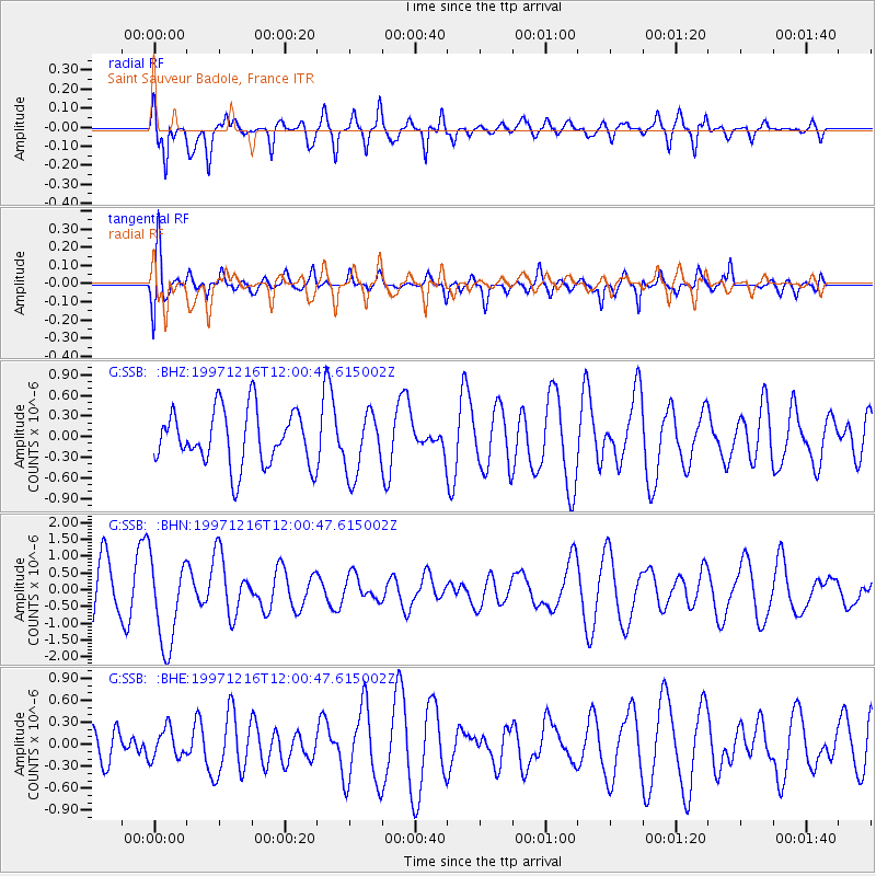
SSB Saint Sauveur Badole, France - Earthquake Result Viewer
*The percent match for this event was below the threshold and hence no stack was calculated.
| Earthquake location: |
Near Coast Of Guerrero, Mexico |
| Earthquake latitude/longitude: |
16.1/-98.9 |
| Earthquake time(UTC): |
1997/12/16 (350) 11:48:29 GMT |
| Earthquake Depth: |
10 km |
| Earthquake Magnitude: |
5.5 MB, 5.5 MS, 6.3 UNKNOWN, 6.2 MW |
| Earthquake Catalog/Contributor: |
WHDF/NEIC |
|
| Network: |
G GEOSCOPE |
| Station: |
SSB Saint Sauveur Badole, France |
| Lat/Lon: |
45.28 N/4.54 E |
| Elevation: |
700 m |
|
| Distance: |
87.8 deg |
| Az: |
43.419 deg |
| Baz: |
290.647 deg |
| Ray Param: |
$rayparam |
*The percent match for this event was below the threshold and hence was not used in the summary stack. |
|
| Radial Match: |
63.6923 % |
| Radial Bump: |
400 |
| Transverse Match: |
52.254097 % |
| Transverse Bump: |
400 |
| SOD ConfigId: |
4480 |
| Insert Time: |
2010-02-27 00:21:08.183 +0000 |
| GWidth: |
2.5 |
| Max Bumps: |
400 |
| Tol: |
0.001 |
|
Signal To Noise
| Channel | StoN | STA | LTA |
| G:SSB: :BHN:19971216T12:00:47.615002Z | 2.042526 | 1.3023822E-6 | 6.376331E-7 |
| G:SSB: :BHE:19971216T12:00:47.615002Z | 0.64699405 | 2.0426484E-7 | 3.1571363E-7 |
| G:SSB: :BHZ:19971216T12:00:47.615002Z | 1.1404706 | 4.5443718E-7 | 3.984646E-7 |
| Arrivals |
| Ps | |
| PpPs | |
| PsPs/PpSs | |


