You are here: Home > Network List > IC - New China Digital Seismograph Network Stations List
> Station LSA Tibet, China > Earthquake Result Viewer
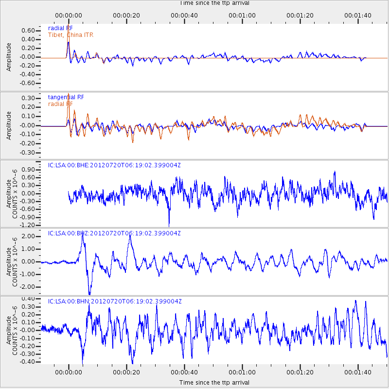
LSA Tibet, China - Earthquake Result Viewer
*The percent match for this event was below the threshold and hence no stack was calculated.
| Earthquake location: |
Kuril Islands |
| Earthquake latitude/longitude: |
49.4/155.9 |
| Earthquake time(UTC): |
2012/07/20 (202) 06:10:25 GMT |
| Earthquake Depth: |
19 km |
| Earthquake Magnitude: |
5.7 MB, 5.7 MS, 6.0 MW, 6.1 MW |
| Earthquake Catalog/Contributor: |
WHDF/NEIC |
|
| Network: |
IC New China Digital Seismograph Network |
| Station: |
LSA Tibet, China |
| Lat/Lon: |
29.70 N/91.13 E |
| Elevation: |
3660 m |
|
| Distance: |
52.0 deg |
| Az: |
273.005 deg |
| Baz: |
48.568 deg |
| Ray Param: |
$rayparam |
*The percent match for this event was below the threshold and hence was not used in the summary stack. |
|
| Radial Match: |
71.5015 % |
| Radial Bump: |
400 |
| Transverse Match: |
67.13807 % |
| Transverse Bump: |
400 |
| SOD ConfigId: |
468427 |
| Insert Time: |
2013-02-21 22:14:57.314 +0000 |
| GWidth: |
2.5 |
| Max Bumps: |
400 |
| Tol: |
0.001 |
|
Signal To Noise
| Channel | StoN | STA | LTA |
| IC:LSA:00:BHZ:20120720T06:19:02.399004Z | 12.069269 | 7.001391E-7 | 5.8010066E-8 |
| IC:LSA:00:BHN:20120720T06:19:02.399004Z | 2.5863078 | 9.567456E-8 | 3.699272E-8 |
| IC:LSA:00:BHE:20120720T06:19:02.399004Z | 1.5978997 | 2.886965E-7 | 1.8067247E-7 |
| Arrivals |
| Ps | |
| PpPs | |
| PsPs/PpSs | |


