You are here: Home > Network List > TA - USArray Transportable Network (new EarthScope stations) Stations List
> Station P40A Paris, MO, USA > Earthquake Result Viewer
P40A Paris, MO, USA - Earthquake Result Viewer

| Earthquake location: |
Kuril Islands |
| Earthquake latitude/longitude: |
49.4/155.9 |
| Earthquake time(UTC): |
2012/07/20 (202) 06:10:25 GMT |
| Earthquake Depth: |
19 km |
| Earthquake Magnitude: |
5.7 MB, 5.7 MS, 6.0 MW, 6.1 MW |
| Earthquake Catalog/Contributor: |
WHDF/NEIC |
|
| Network: |
TA USArray Transportable Network (new EarthScope stations) |
| Station: |
P40A Paris, MO, USA |
| Lat/Lon: |
39.53 N/92.05 W |
| Elevation: |
225 m |
|
| Distance: |
73.1 deg |
| Az: |
48.515 deg |
| Baz: |
320.75 deg |
| Ray Param: |
0.05319705 |
| Estimated Moho Depth: |
40.25 km |
| Estimated Crust Vp/Vs: |
1.82 |
| Assumed Crust Vp: |
6.498 km/s |
| Estimated Crust Vs: |
3.58 km/s |
| Estimated Crust Poisson's Ratio: |
0.28 |
|
| Radial Match: |
83.26224 % |
| Radial Bump: |
400 |
| Transverse Match: |
69.37203 % |
| Transverse Bump: |
400 |
| SOD ConfigId: |
468427 |
| Insert Time: |
2013-02-21 22:43:35.671 +0000 |
| GWidth: |
2.5 |
| Max Bumps: |
400 |
| Tol: |
0.001 |
|
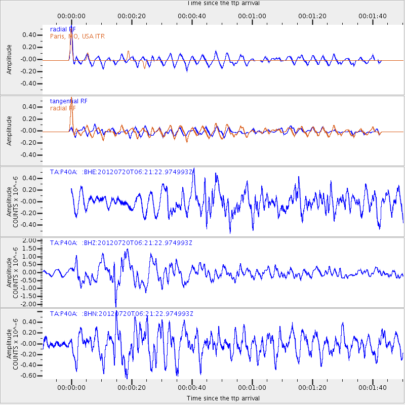
Signal To Noise
| Channel | StoN | STA | LTA |
| TA:P40A: :BHZ:20120720T06:21:22.974993Z | 4.003592 | 5.042652E-7 | 1.2595318E-7 |
| TA:P40A: :BHN:20120720T06:21:22.974993Z | 1.5776159 | 2.15719E-7 | 1.3673734E-7 |
| TA:P40A: :BHE:20120720T06:21:22.974993Z | 1.7693102 | 1.9570786E-7 | 1.1061252E-7 |
| Arrivals |
| Ps | 5.2 SECOND |
| PpPs | 17 SECOND |
| PsPs/PpSs | 22 SECOND |


