You are here: Home > Network List > TA - USArray Transportable Network (new EarthScope stations) Stations List
> Station Z46A Louisville, MS, USA > Earthquake Result Viewer
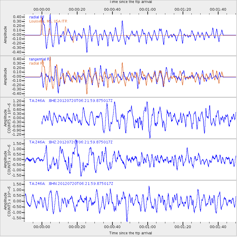
Z46A Louisville, MS, USA - Earthquake Result Viewer
*The percent match for this event was below the threshold and hence no stack was calculated.
| Earthquake location: |
Kuril Islands |
| Earthquake latitude/longitude: |
49.4/155.9 |
| Earthquake time(UTC): |
2012/07/20 (202) 06:10:25 GMT |
| Earthquake Depth: |
19 km |
| Earthquake Magnitude: |
5.7 MB, 5.7 MS, 6.0 MW, 6.1 MW |
| Earthquake Catalog/Contributor: |
WHDF/NEIC |
|
| Network: |
TA USArray Transportable Network (new EarthScope stations) |
| Station: |
Z46A Louisville, MS, USA |
| Lat/Lon: |
33.19 N/88.94 W |
| Elevation: |
125 m |
|
| Distance: |
79.6 deg |
| Az: |
50.496 deg |
| Baz: |
323.054 deg |
| Ray Param: |
$rayparam |
*The percent match for this event was below the threshold and hence was not used in the summary stack. |
|
| Radial Match: |
67.1969 % |
| Radial Bump: |
400 |
| Transverse Match: |
67.694115 % |
| Transverse Bump: |
400 |
| SOD ConfigId: |
468427 |
| Insert Time: |
2013-02-21 22:53:27.557 +0000 |
| GWidth: |
2.5 |
| Max Bumps: |
400 |
| Tol: |
0.001 |
|
Signal To Noise
| Channel | StoN | STA | LTA |
| TA:Z46A: :BHZ:20120720T06:21:59.875017Z | 5.18349 | 6.258464E-7 | 1.2073842E-7 |
| TA:Z46A: :BHN:20120720T06:21:59.875017Z | 1.4851115 | 4.6986574E-7 | 3.1638413E-7 |
| TA:Z46A: :BHE:20120720T06:21:59.875017Z | 1.2361214 | 3.073904E-7 | 2.486733E-7 |
| Arrivals |
| Ps | |
| PpPs | |
| PsPs/PpSs | |


